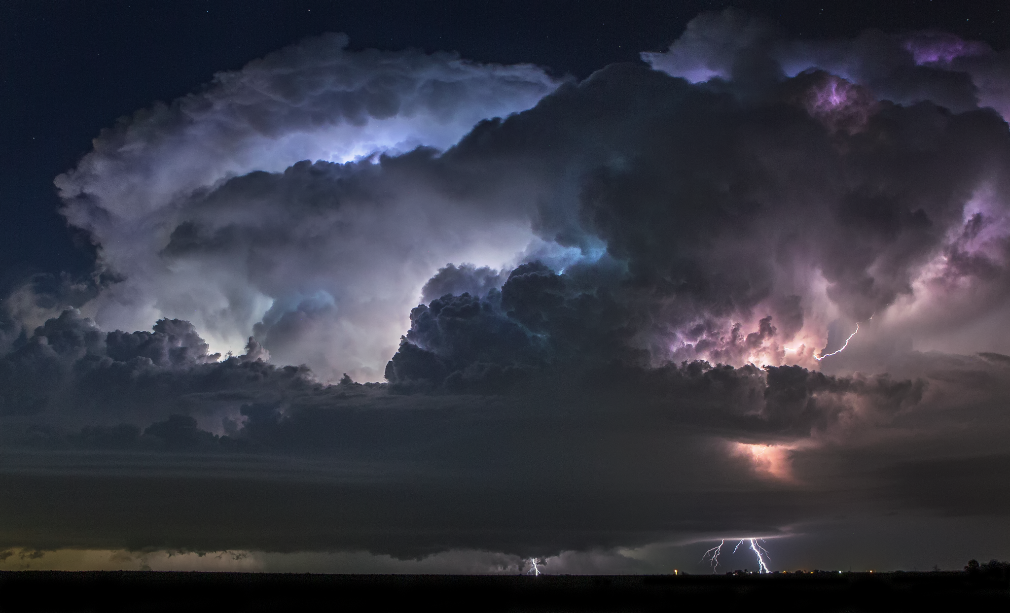
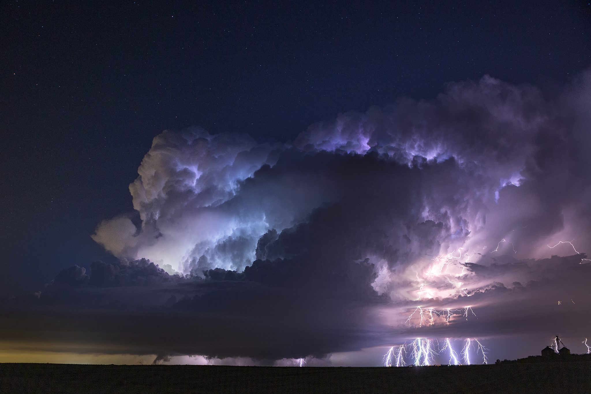
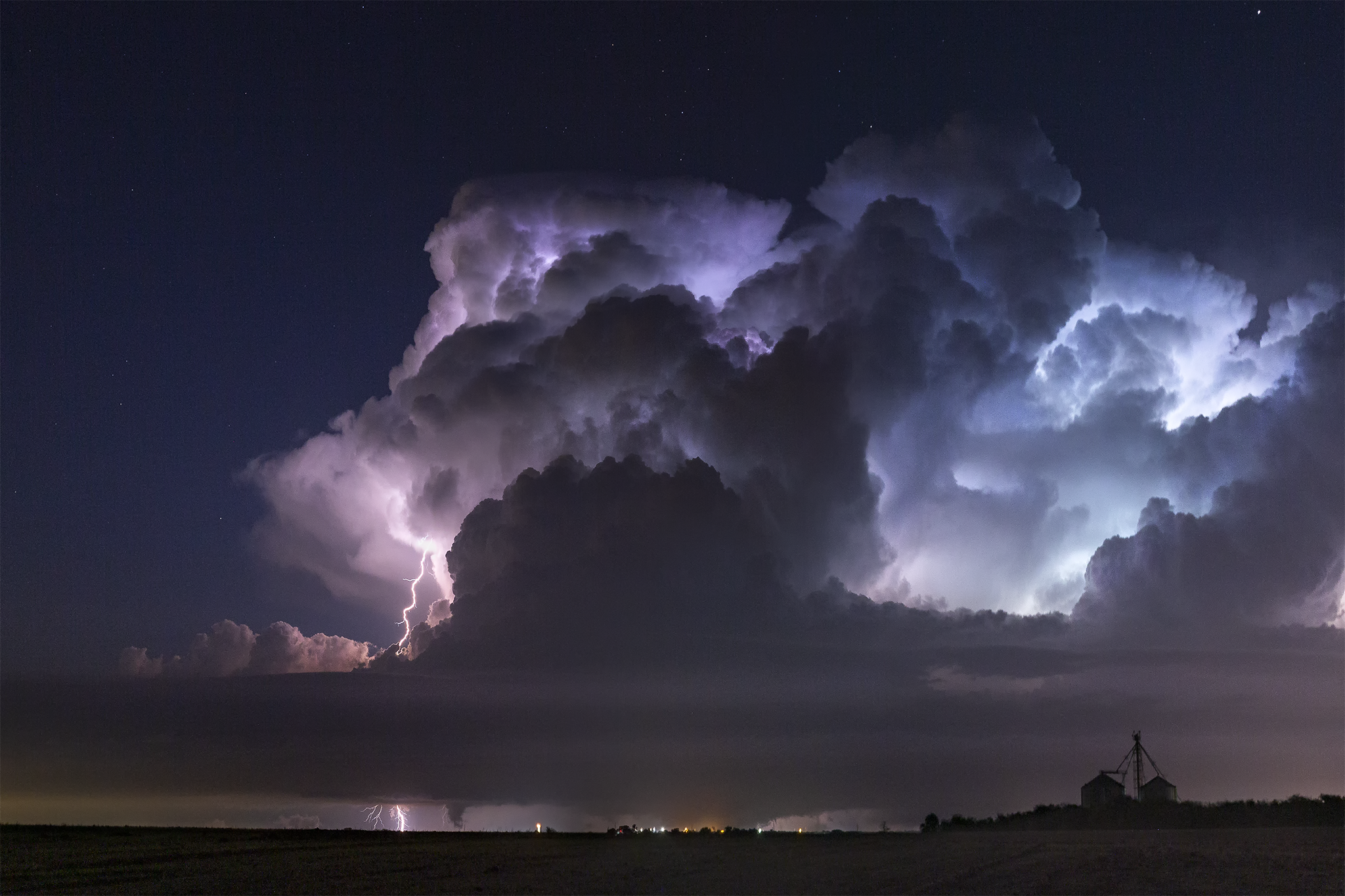
October 21, 2019 -
Dallas County Tornadoes
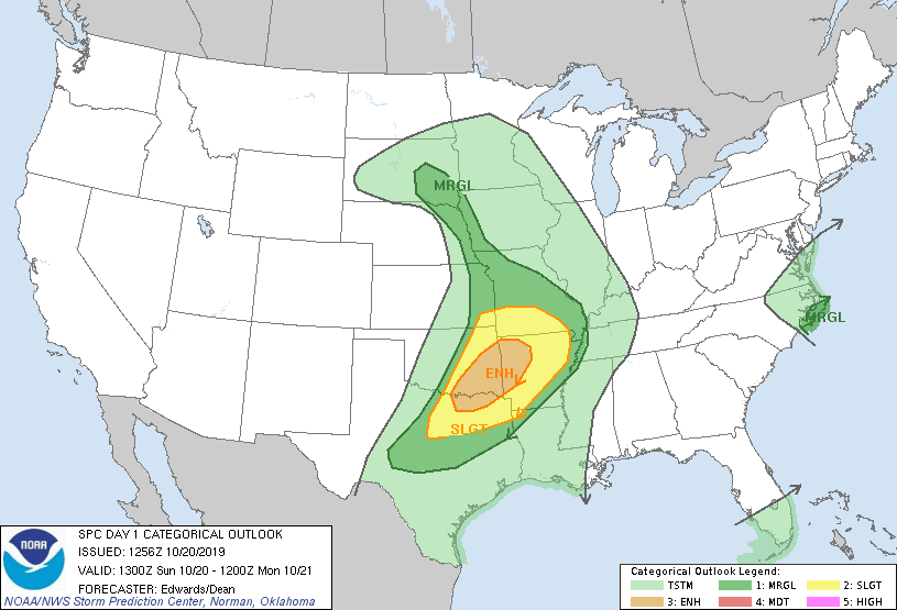
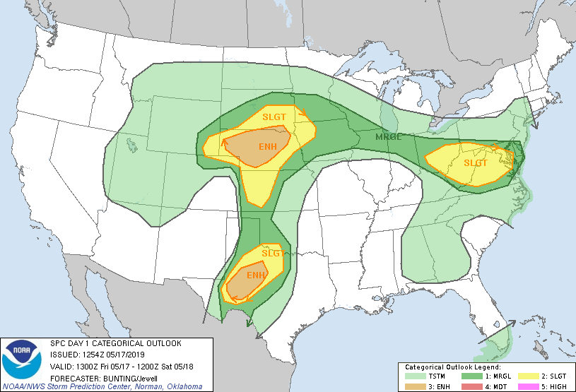
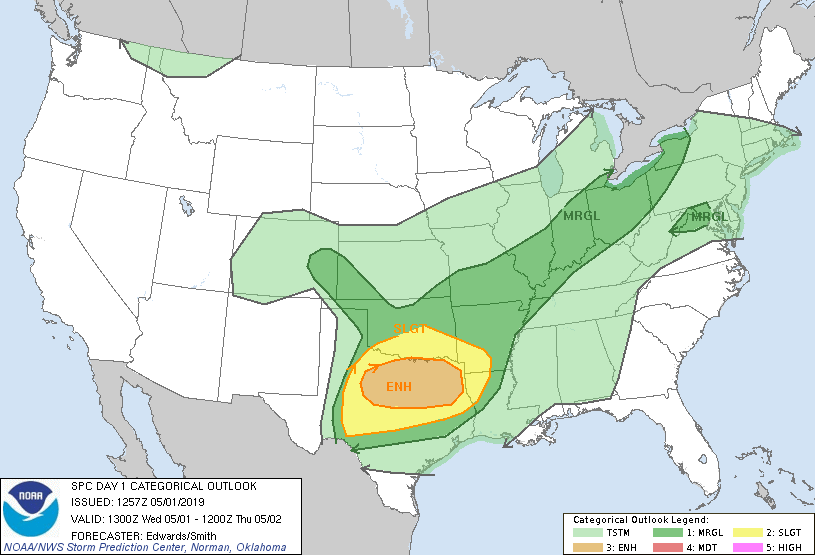
This wasn’t really a chase day, but I felt the need to include it. The day was given an Enhanced Risk around the Arklatex region (not a fun place to chase) by the Storm Prediction Center. Looking at the forecast model runs in the morning, and the days leading up to it, I noticed a tendency for storms to break out in the warm sector on some runs (but not others), ahead of the cold front, where storm relative helicity is usually high. Storms in this environment have a propensity to produce tornadoes.
Sure enough, late afternoon, some storms went up to the southwest of the DFW metro. Got the kids winded down, had a sitter come over, and we headed north on I-35. I had zero interest in going up into the metro, after dark, to chase tornadoes at close range, so instead we setup on the south side of it all and watched the structure lit by continuous lightning with tornadoes causing power flashes. In all 9 tornadoes, including an EF3, were confirmed from two supercells. Miraculously, nobody was seriously injured or killed.
june 4, 2019 -
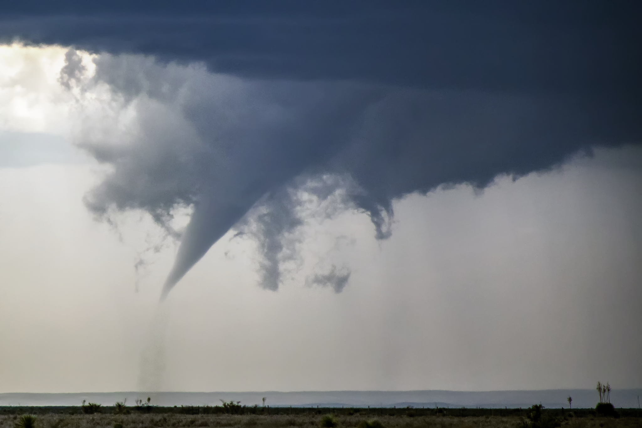
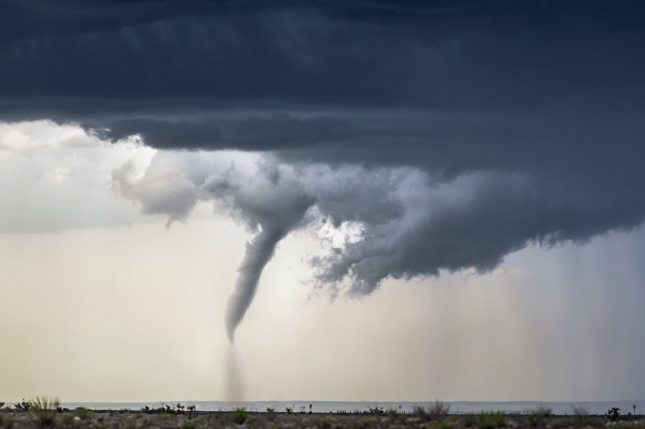
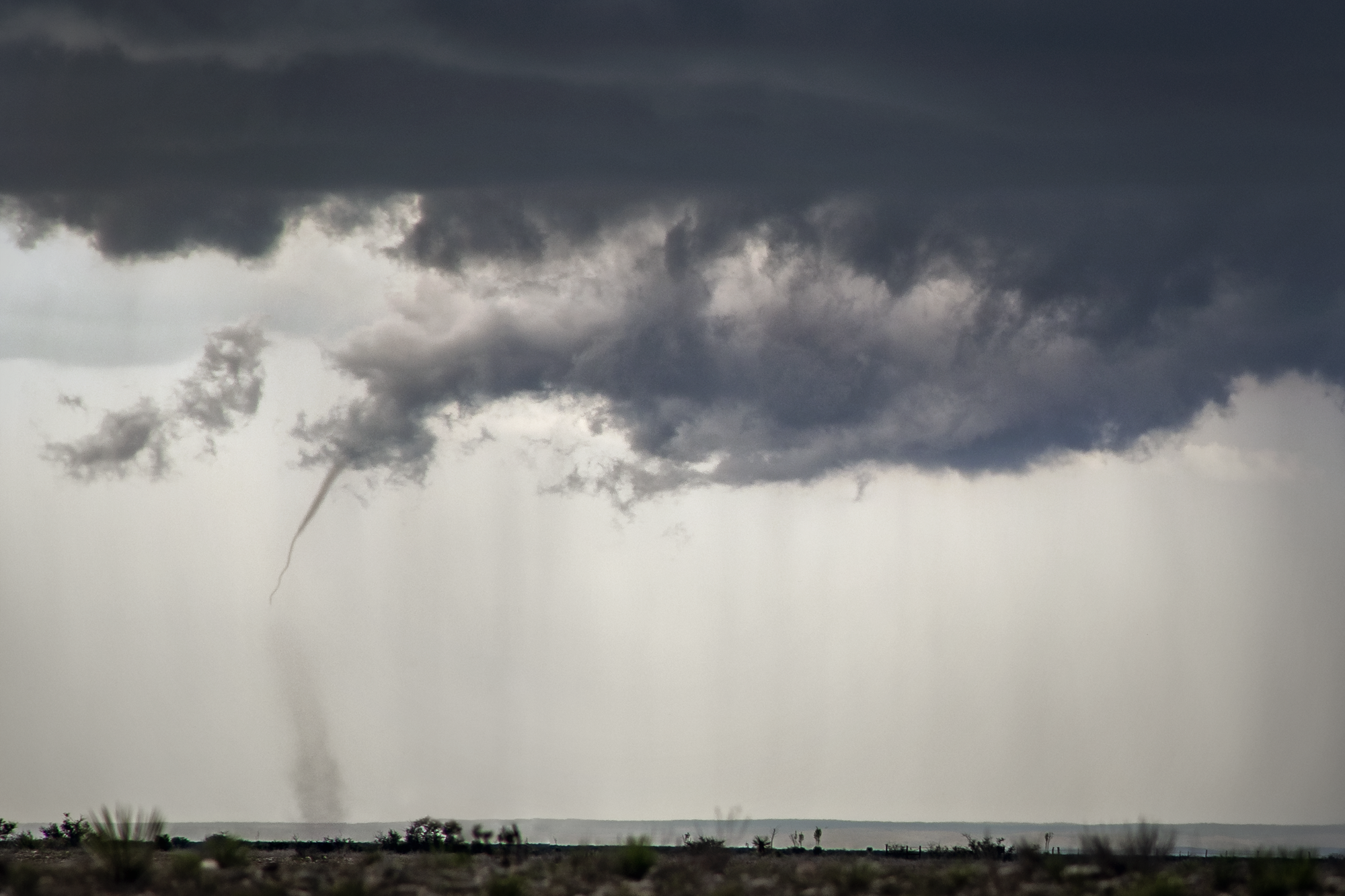
hope, new mexico tornado
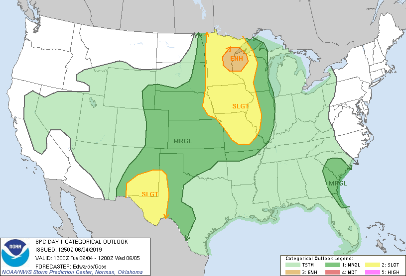
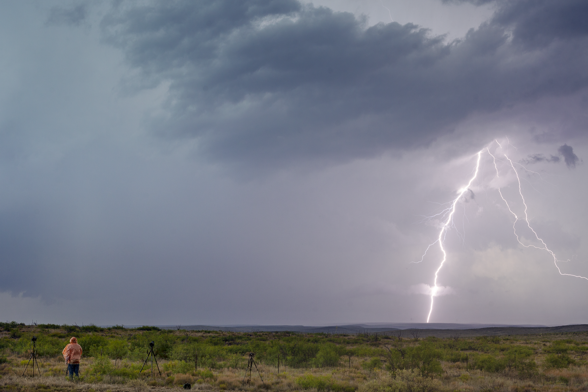
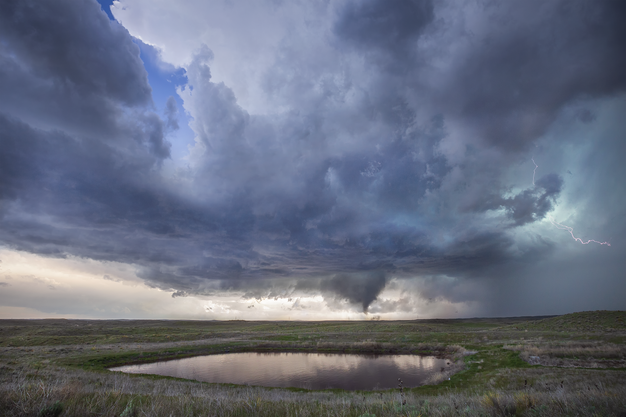
This was our third straight day in Southeastern New Mexico. The Storm Prediction Center had issued a Slight Risk for the area with a 2% chance of a tornado.
After watching a severe storm shrivel up, we headed to a gas station for a snack break. Hoping the atmosphere would recover and squeeze out another storm. It did, and the tiny storm produced a pretty rope tornado that lasted for several minutes near the town of Hope, New Mexico. The storm never had a severe or tornado warning, most likely due to poor radar coverage in this part of the country.
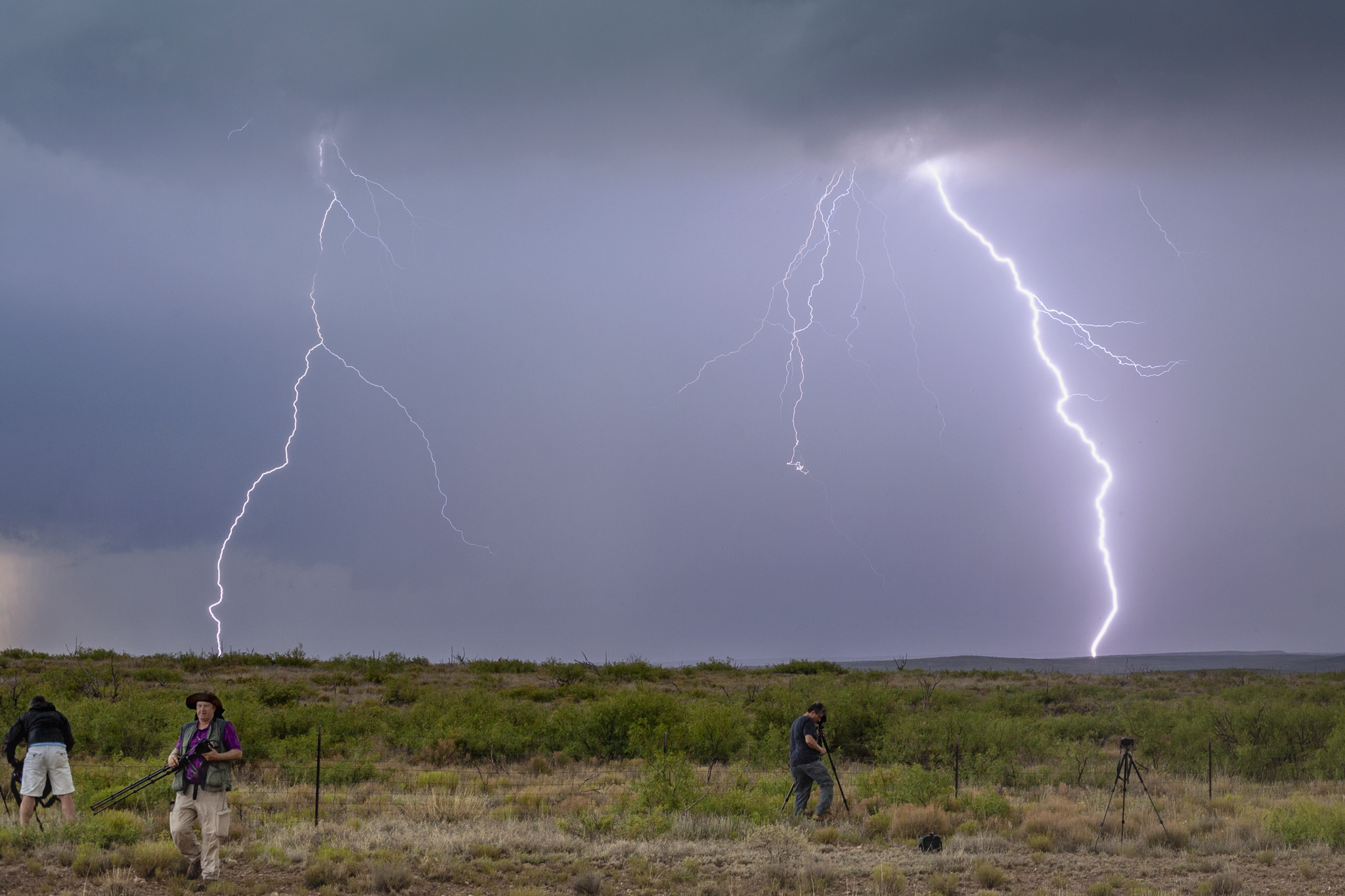
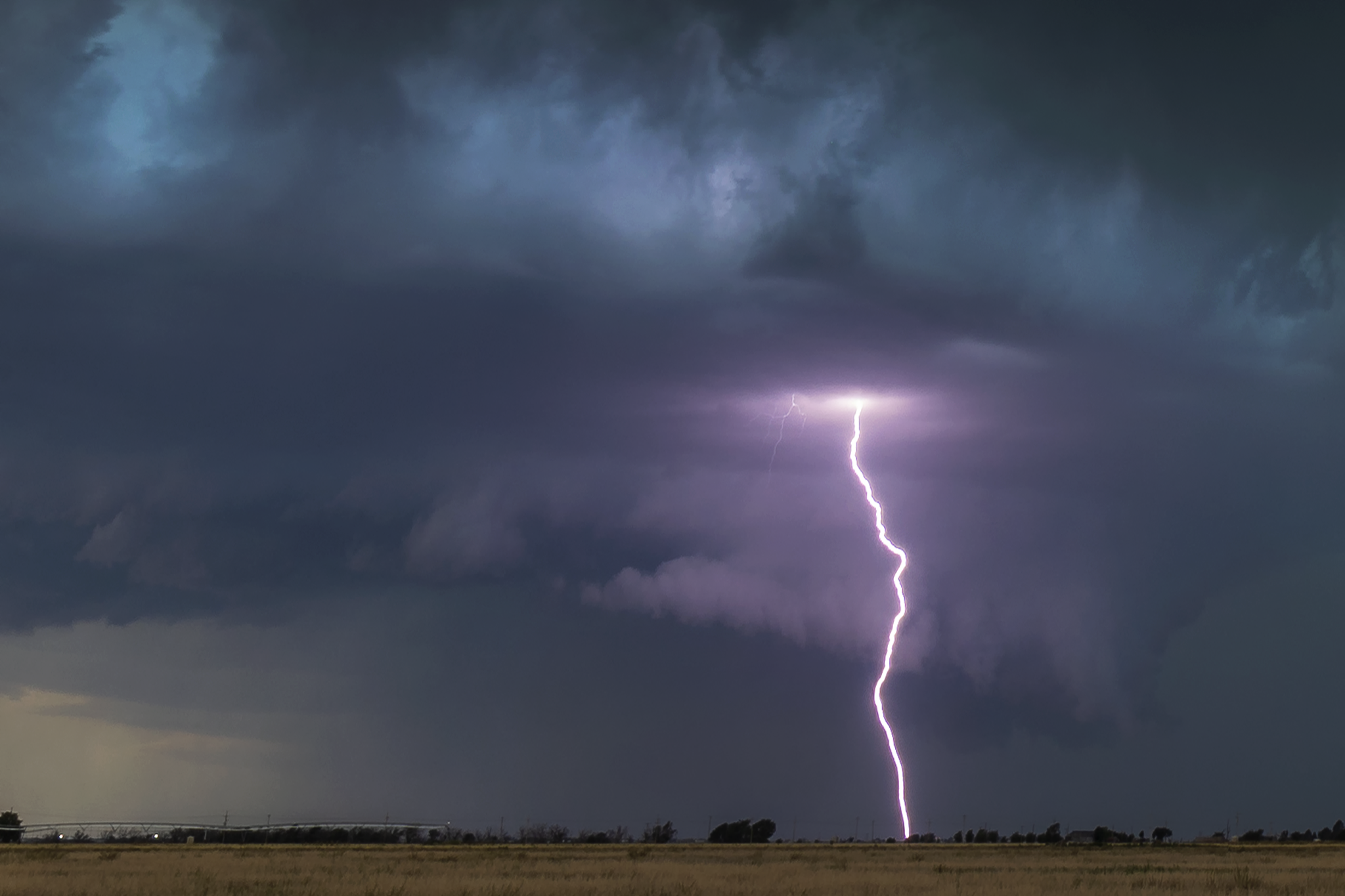
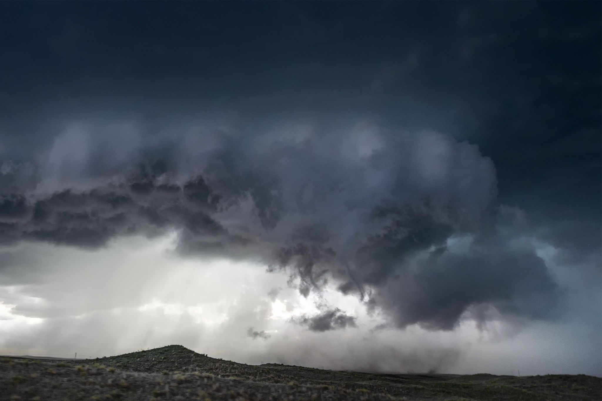
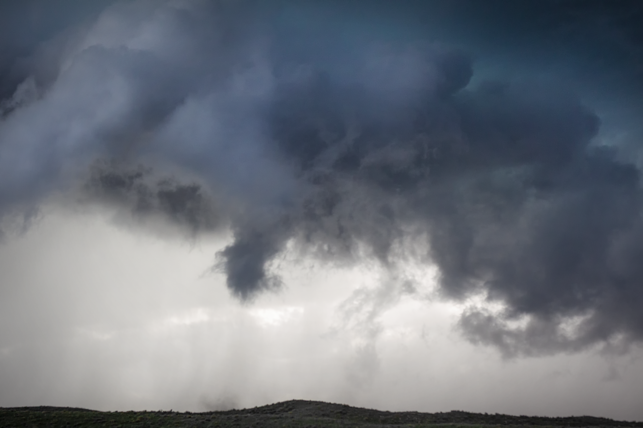
June 3, 2019 - Multiple Tornado Warned Supercells Around Roswell, New Mexico
This day looked pretty low end, but overperformed for a Slight Risk with less than 2% tornado probabilities. A storm fired early in the mountains west of Roswell, so we headed out Highway 380 and waited for it to move towards our position. The road network there is extremely limited, so patience is a virtue chasing this part of the country.
The storm was instantly severe warned and took on supercell characteristics, before acquiring rotation and becoming tornado warned. We shot some lightning pacing back towards Roswell with the storm. As it approached the west side of town, a large wall cloud emerged and likely briefly spun up a tornado beneath it.
The storm eventually died south of Roswell but was immediately replaced by a new tornado warned supercell. This storm had exceptional structure and lightning, but we did not observe a tornado with it.
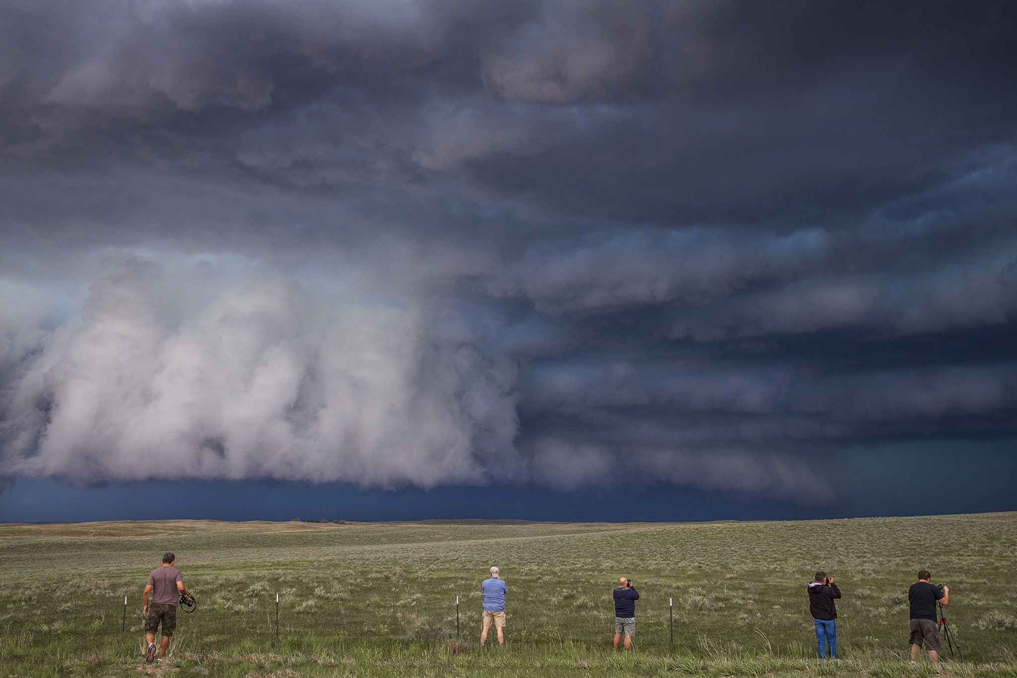
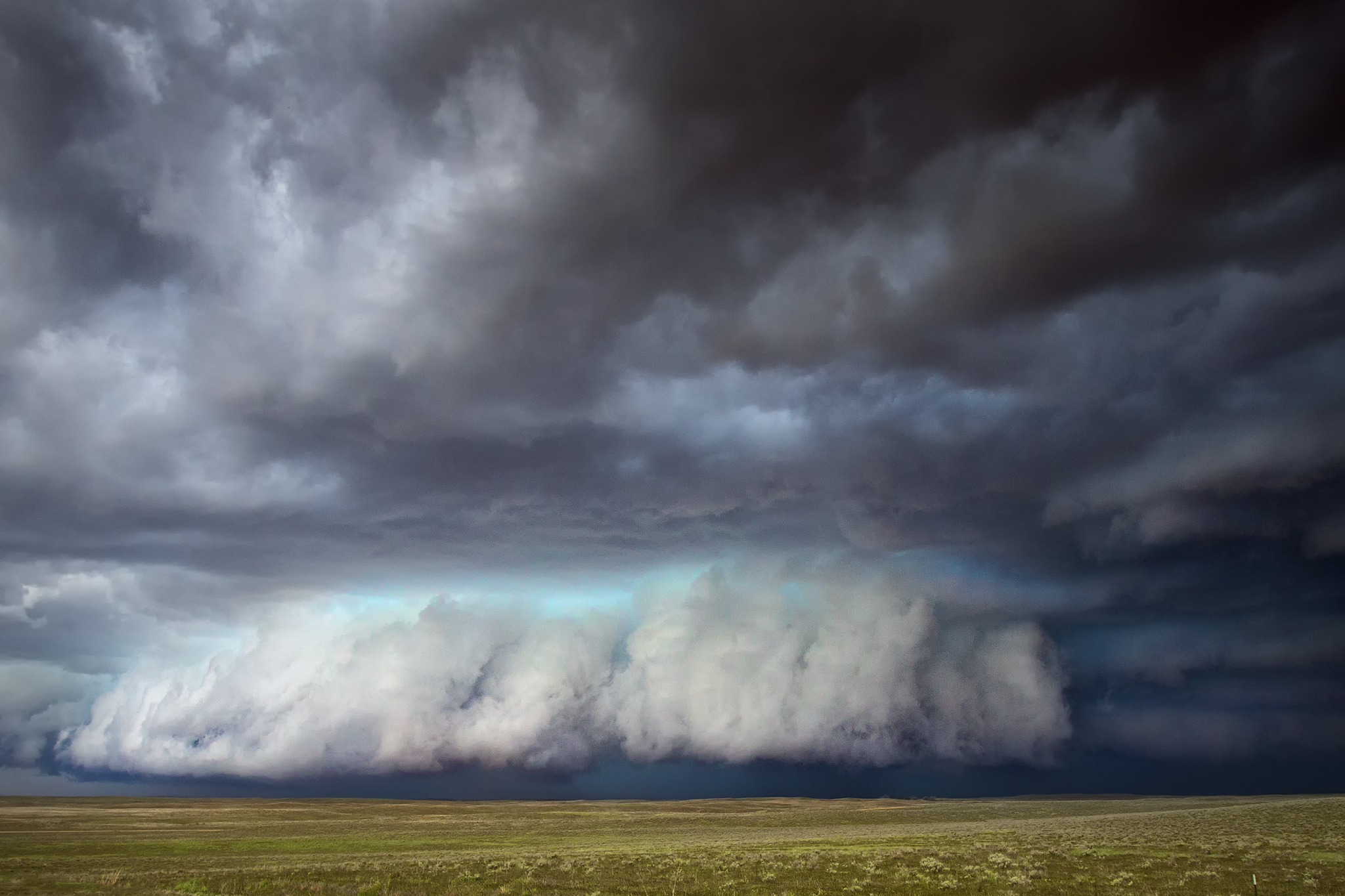
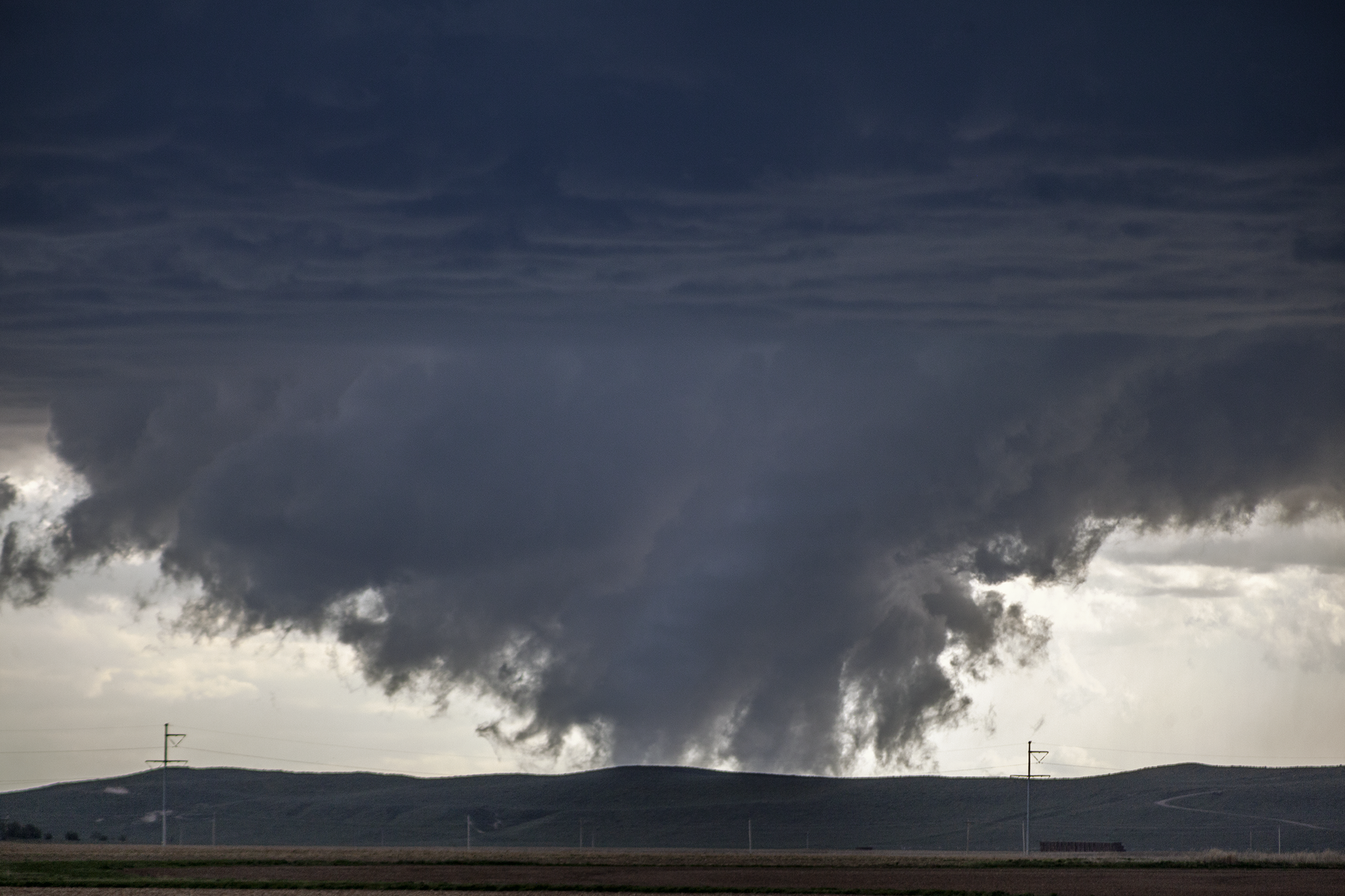
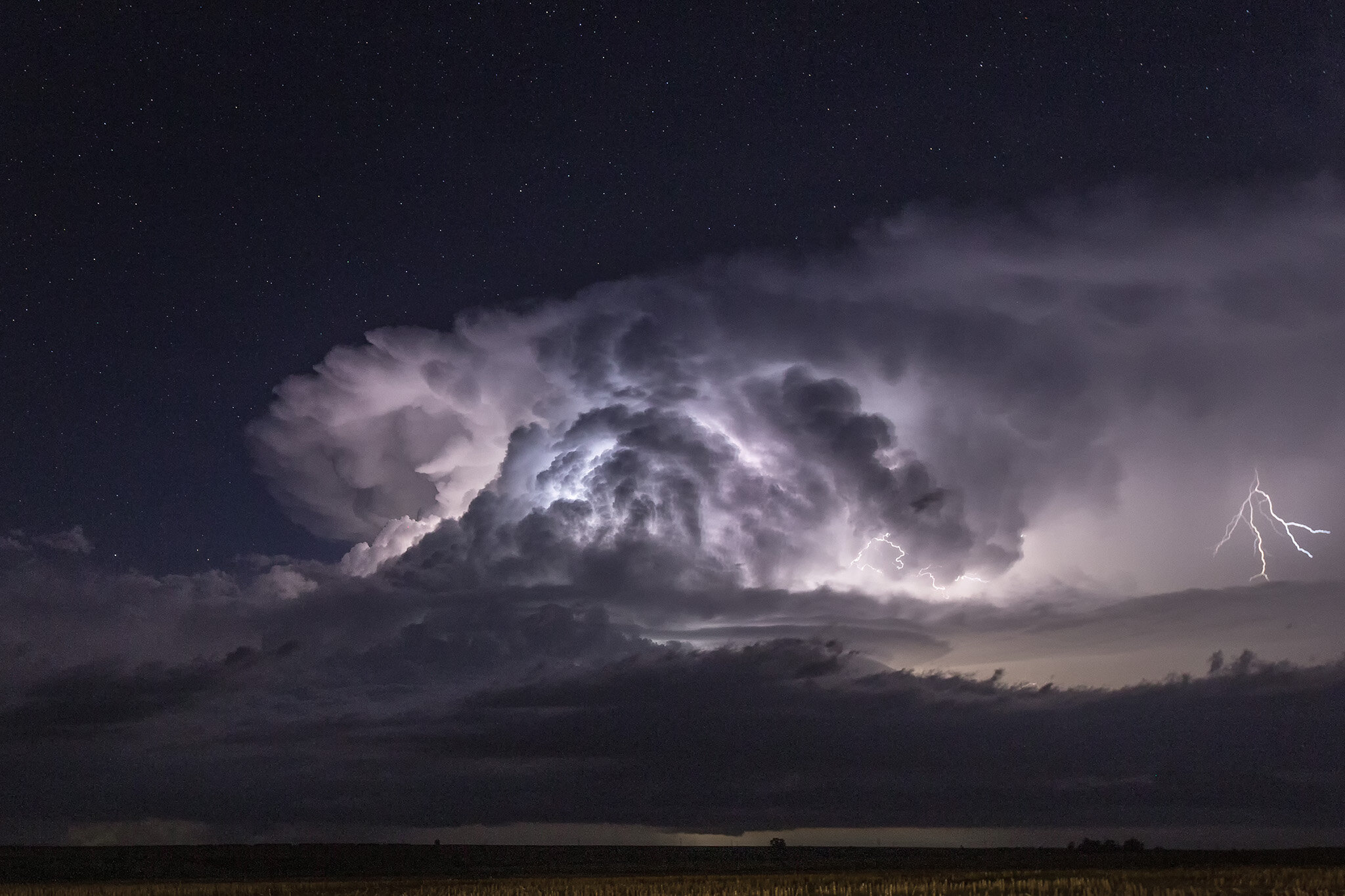
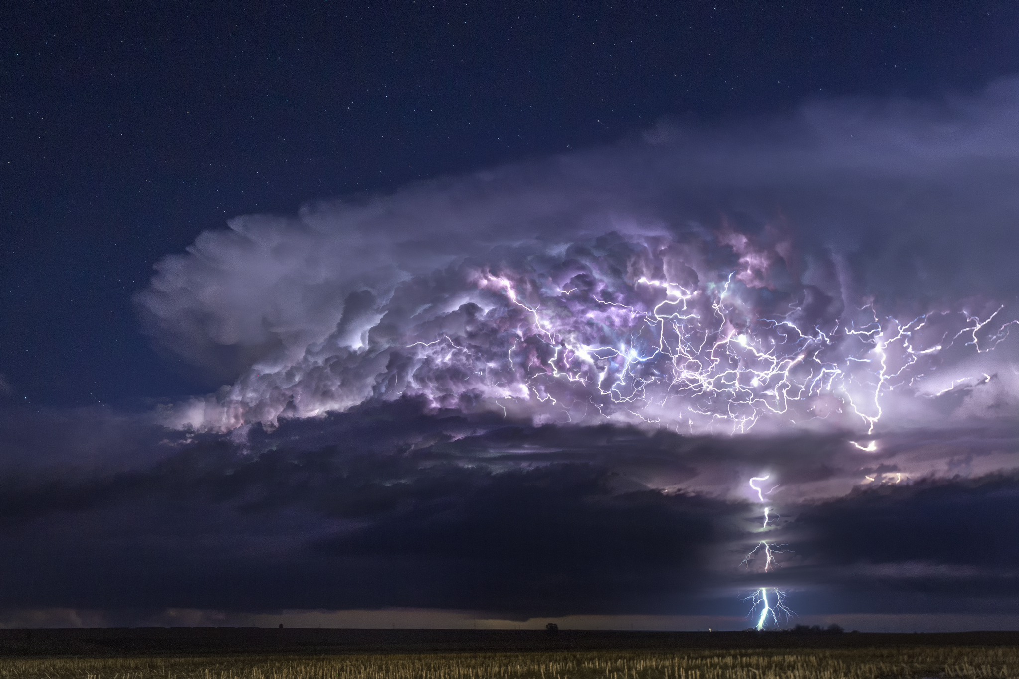
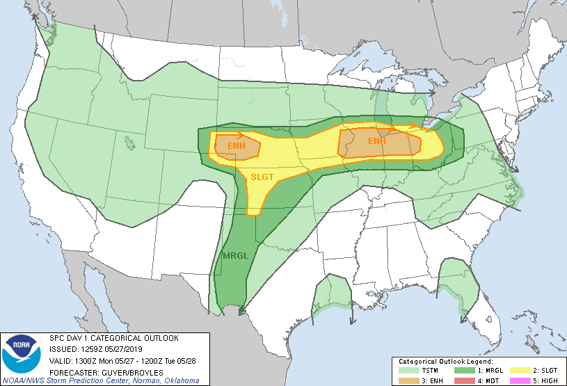
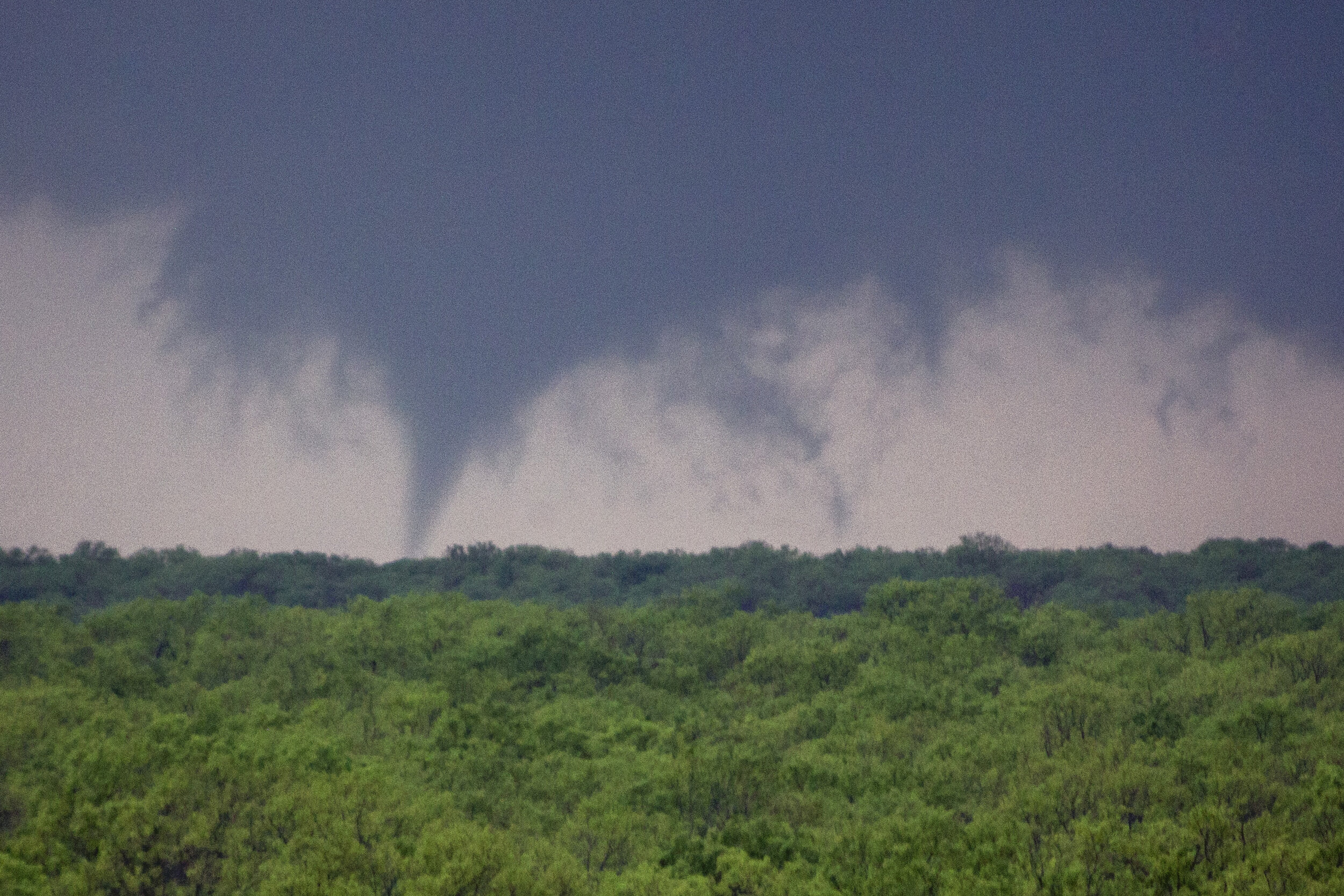
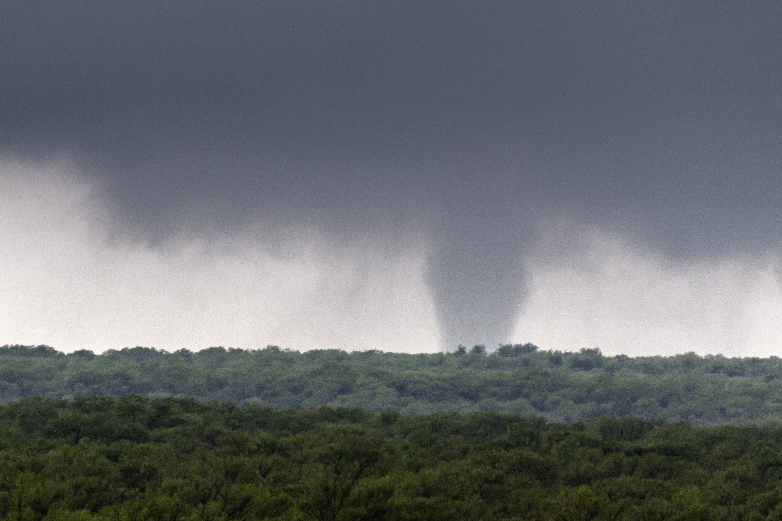
May 27, 2019 - three tornadoes in eastern colorado. nocturnal structure in nebraska
We started the day in Denver after chasing some tornado warned storms the previous day in eastern Colorado, which failed to produce tornadoes. The day was an Enhanced Risk in High Plains, with a 5% tornado, although we thought the risk area was placed a bit too far northeast.
We chased a small storm that grew into a monster HP supercell near Sterling, Colorado. The storm was tornado warned with brief spinups buried in the rain. We stayed ahead of the storm shooting some incredible structure. A new storm fired to the south, so we bailed to it and watched a brief tornado in the distance as it neared our position south of Holyoke.
The storm produced a multiple vortex tornado a few miles from our vantage point, then another as it crossed the road behind us. We finished the night with some jaw dropping nocturnal storm structure in McCook, Nebraska.
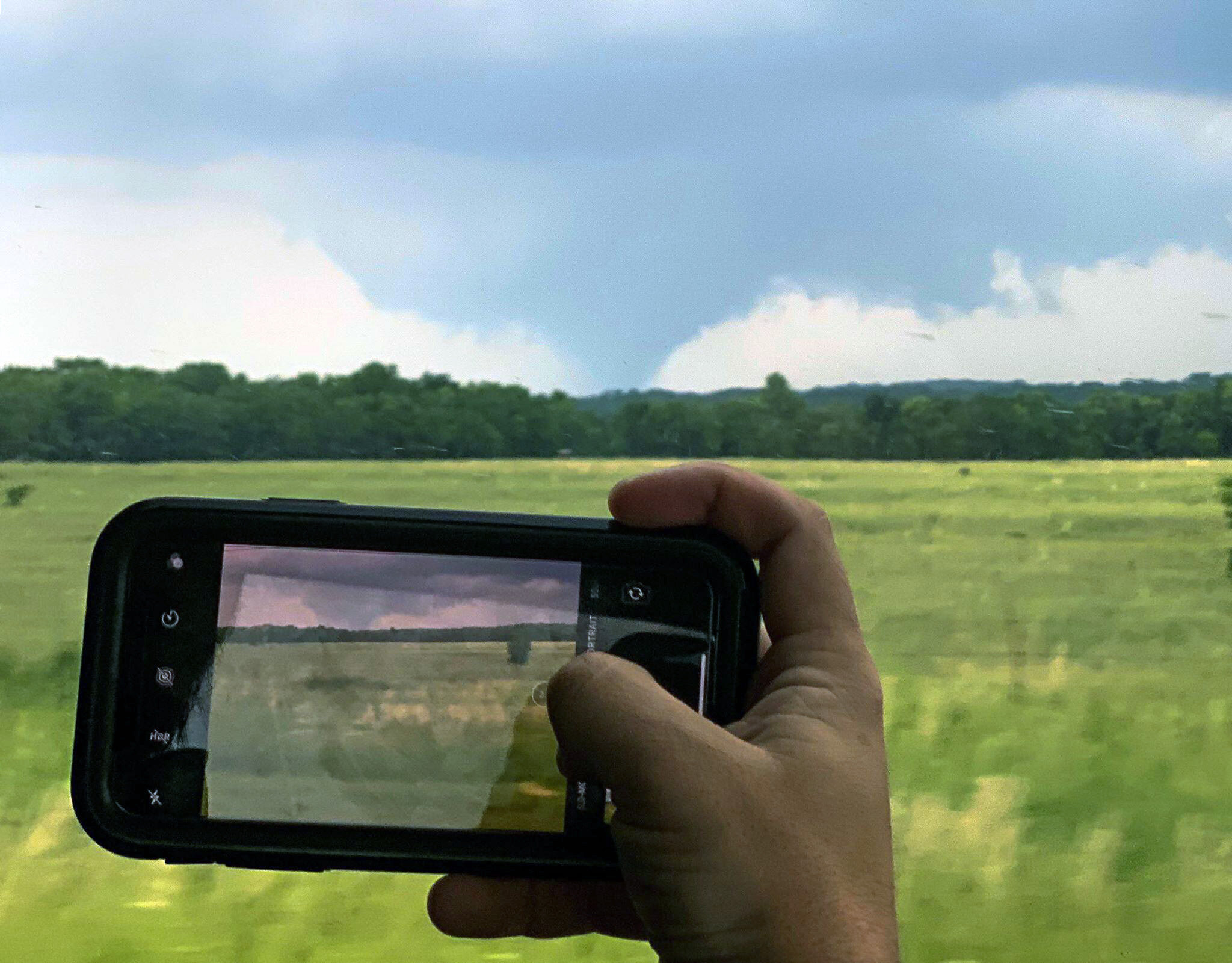
May 22, 2019 - Okmulgee, Oklahoma
Tornado
Flooding grew to a big issue 2019. The shear amount of moisture also caused daily bouts of storms accompanied by thick haze, making chasing extremely difficult as you couldn’t see the storms until you got very close to them. The Oklahoma/Kansas border had grown into an absolute mess with severe flooding to the point that Interstate 35 had to be closed on multiple occasions. This handcuffed where we could safely target and chase throughout the middle of the month.
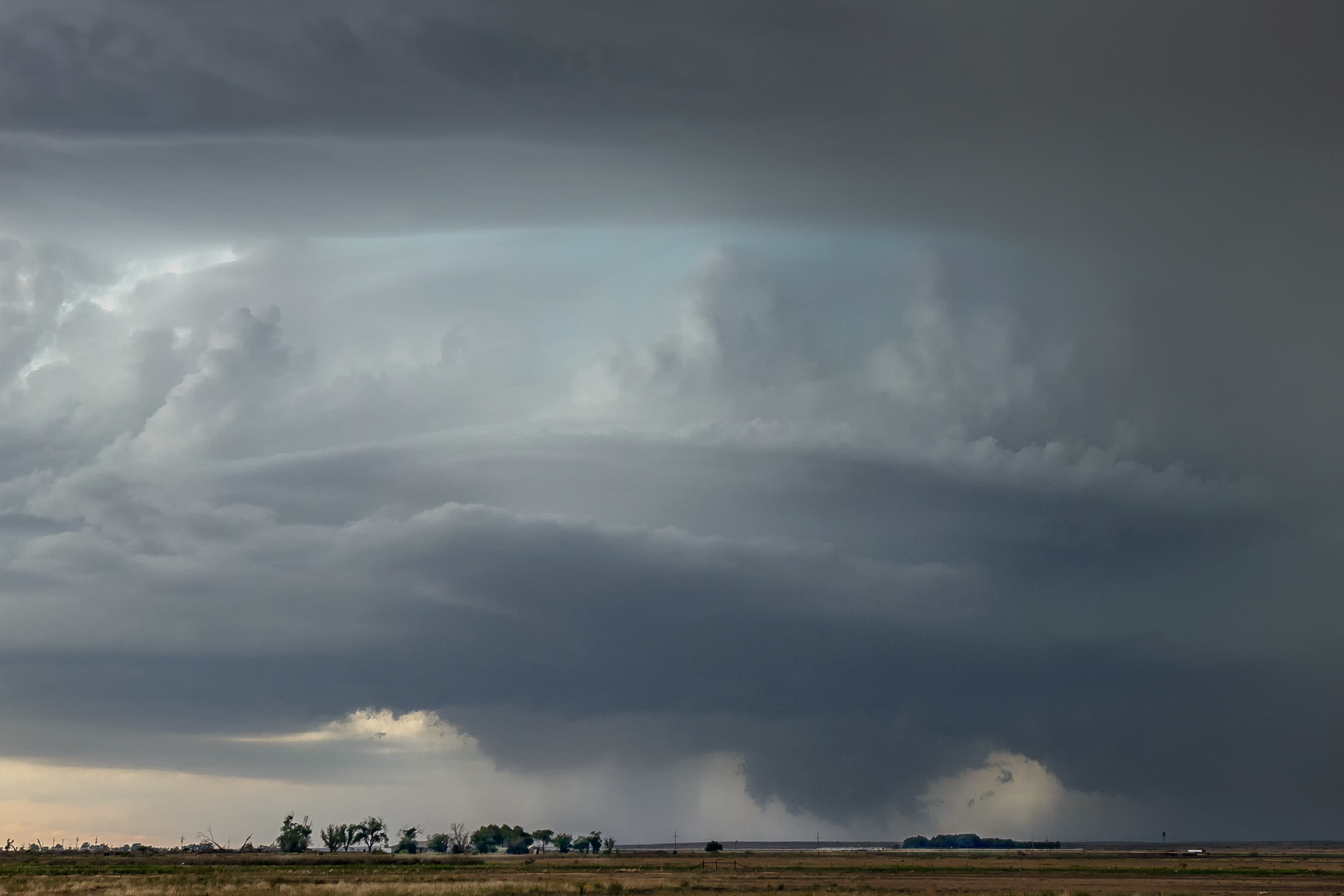
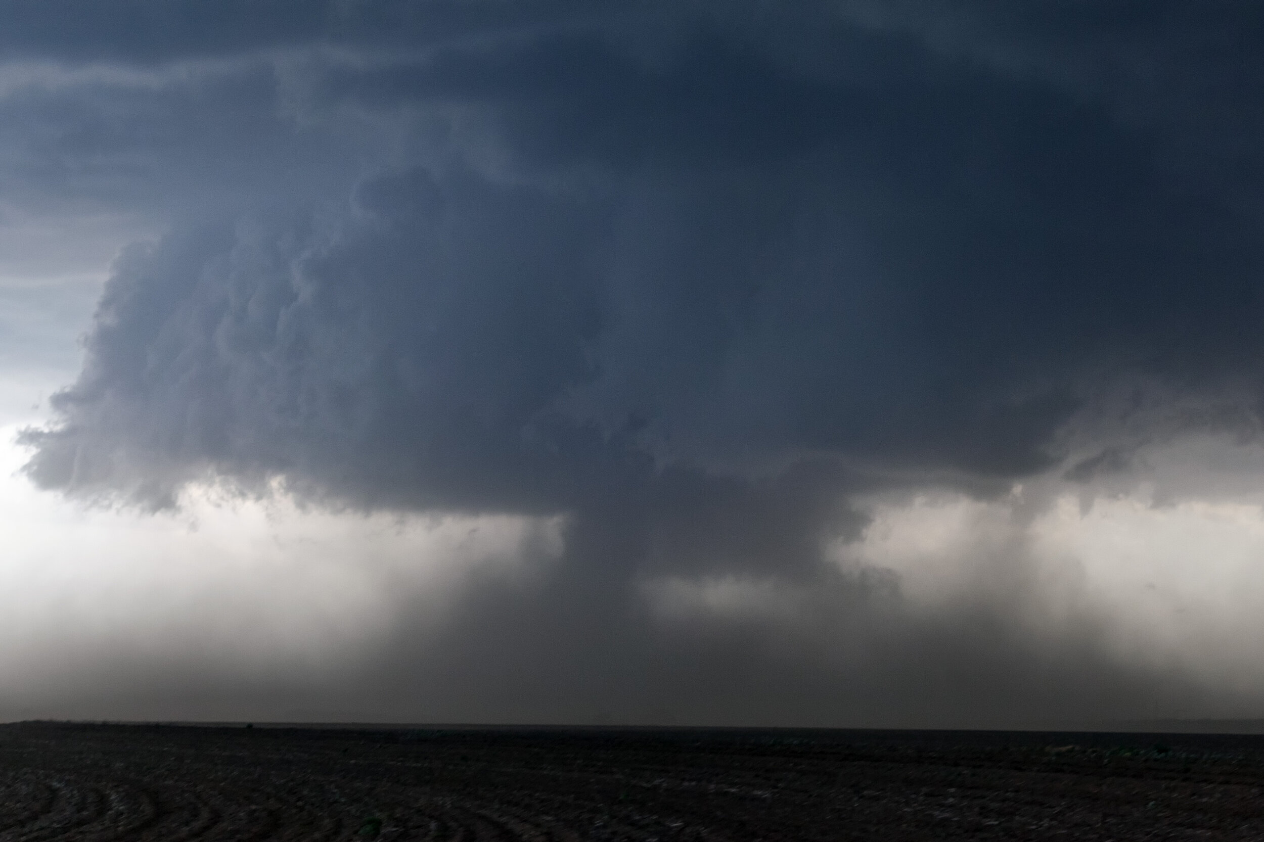
After a couple tough chase days, we targeted the Oklahoma City metro on May 22. Several storms of interest exploded. One in southwest Oklahoma. One just north of OKC metro and another to the east. We were working our way through traffic and knew that whatever decision made we had to stick with because there was no getting back through traffic to the other side of the city. We chose east, even though the terrain was worst there. It was the right decision, as the other two storms died and we got a glimpse of a large tornado.
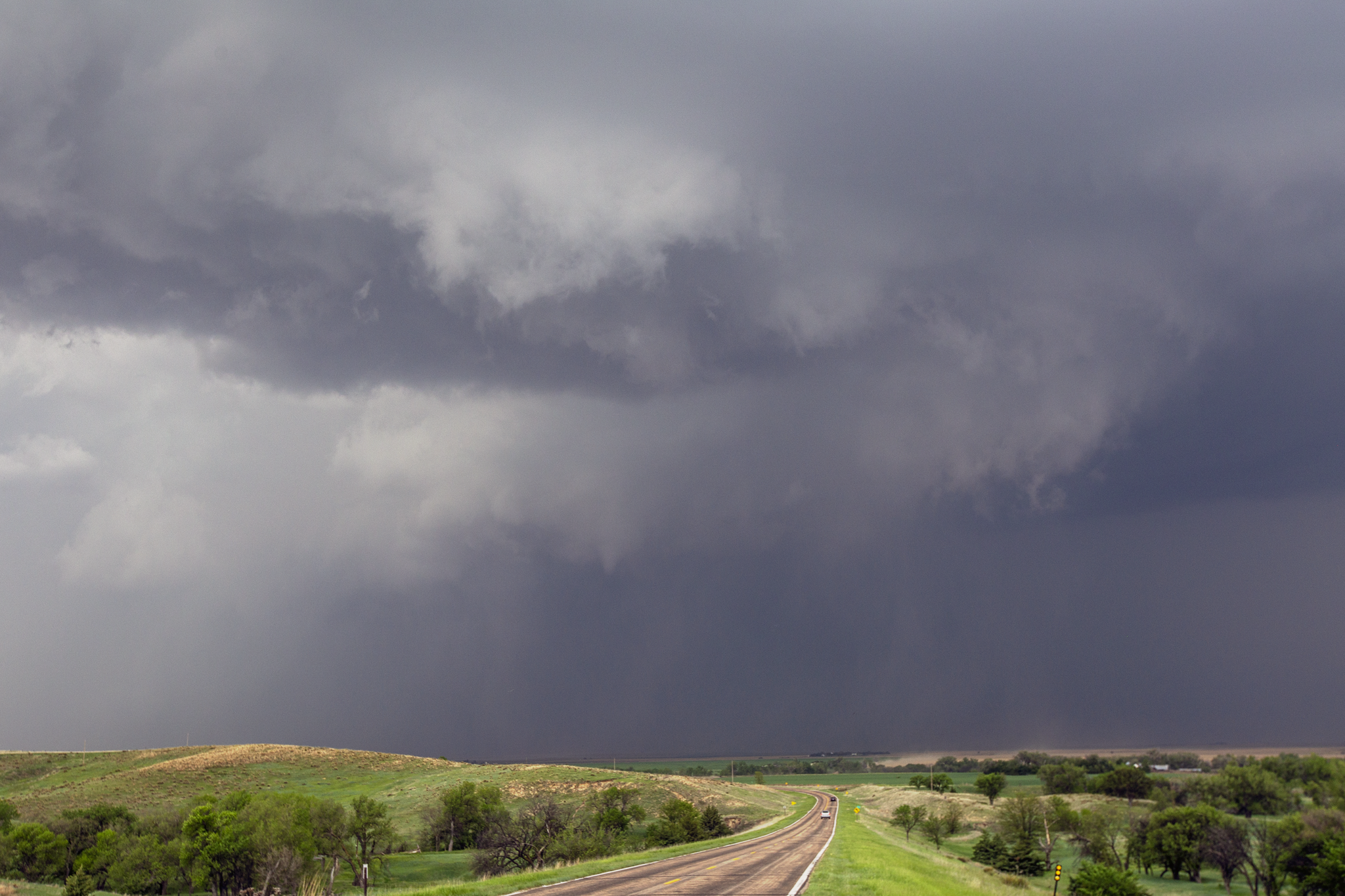
May 17, 2019 - mcCook, nebraska
close tornado intercept
The second week of May was pretty quiet in 2019, with the only appreciable setups being in Dixie Alley. Trees, floods, and scrubby looking storms did not make for great photography, but the Plains awoke again past the midway point in the month.
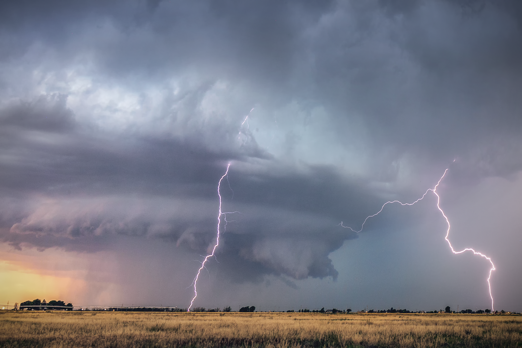
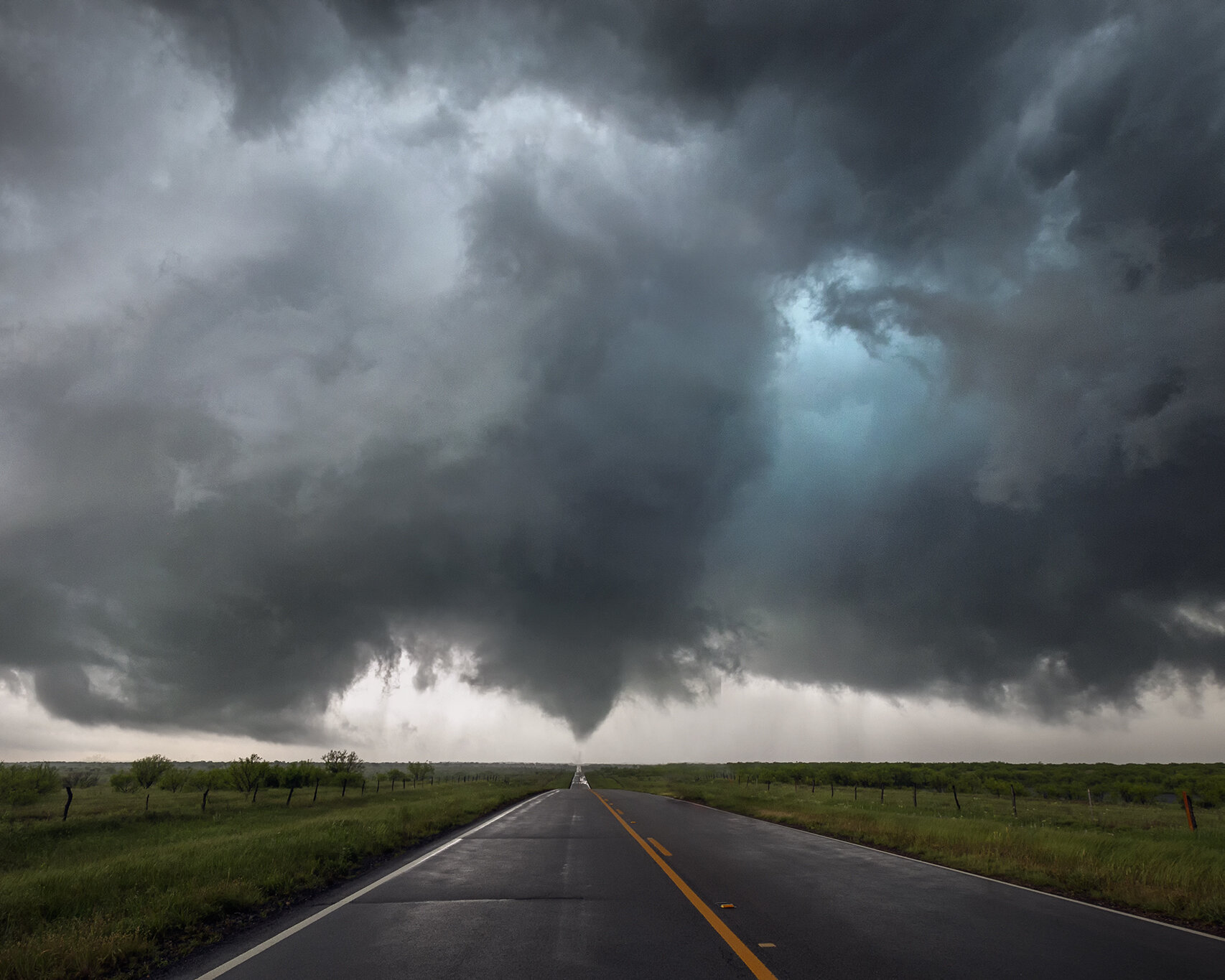
On May 17th, we were split between two targets. One near Dodge City, KS and the other in Southwest Nebraska. Waking up on the Red River north of Dallas, we elected to go with the northern target as it looked more certain, with models going back and forth on a storm forming in southwest Kansas or not.
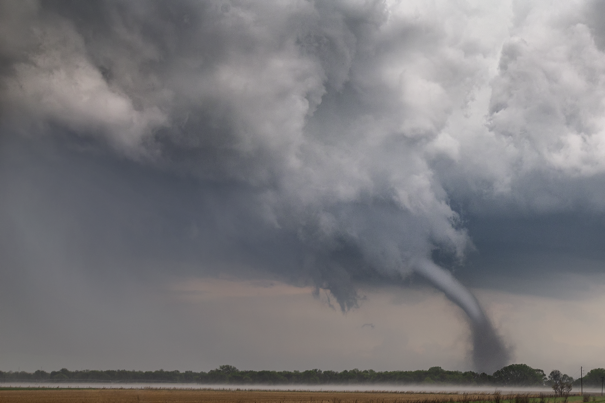
We had to hustle, but made it to the storm just as the first tornado warning was issued. The storm initially appeared partially elevated but had some very large hail. Due to a poor road network, we let the hailcore cross before heading north to catch back up to the hook. We observed a carved out occluded mesocyclone, and just southeast of it, a lowering off the new mesocyclone. Tornado! We hurried east and caught what is probably the most photogenic tornado I have seen to date, lit white with a dusty base.
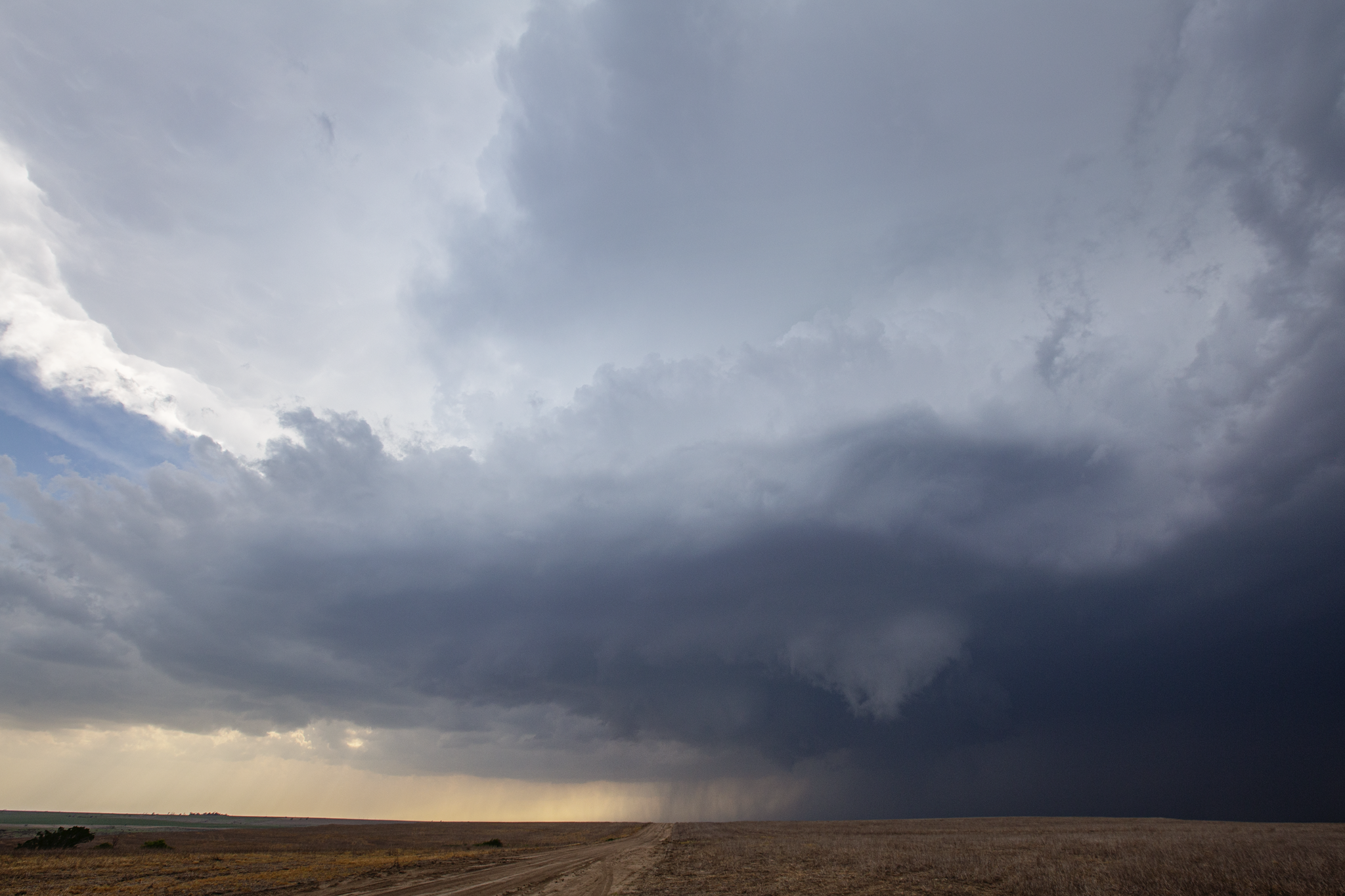
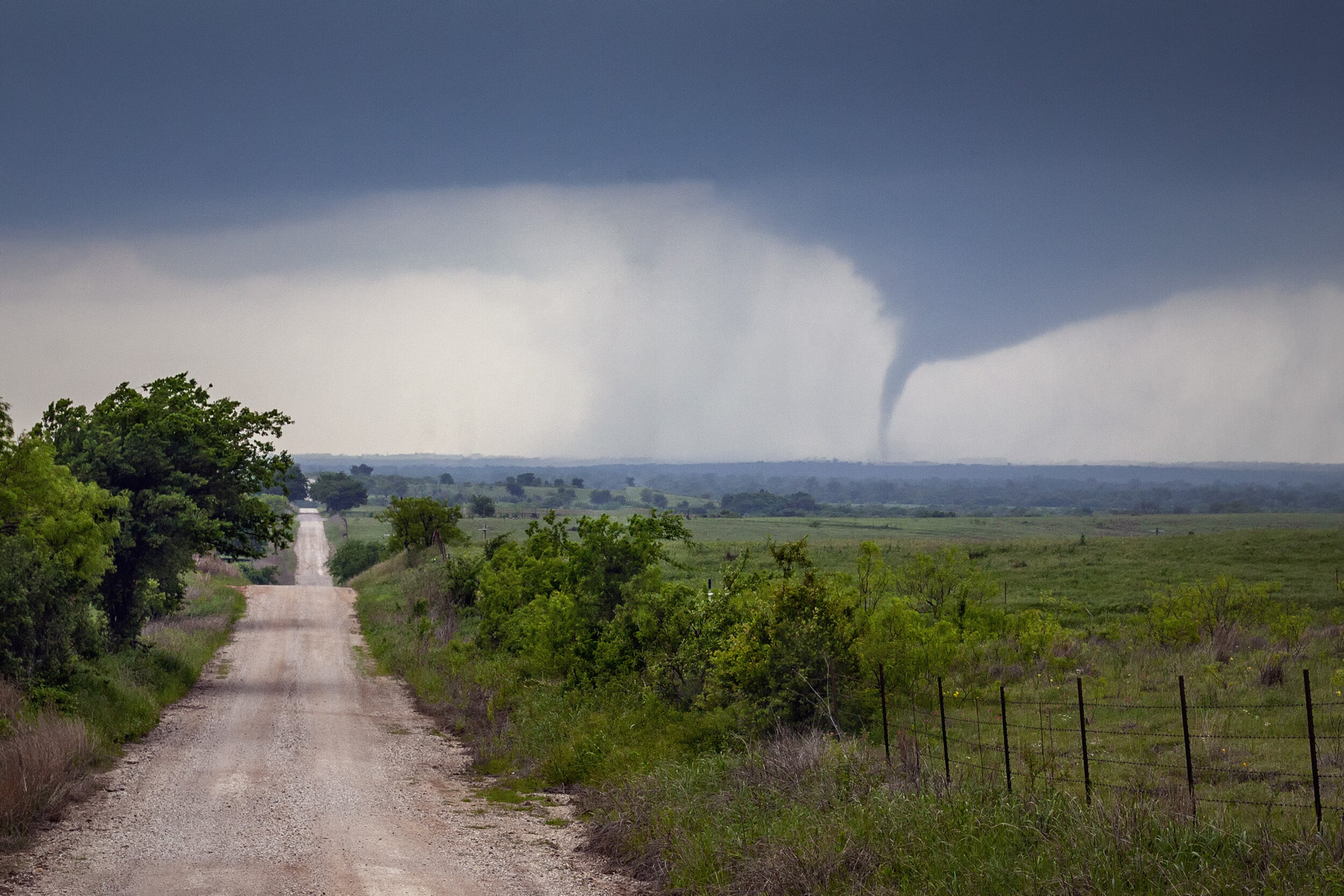
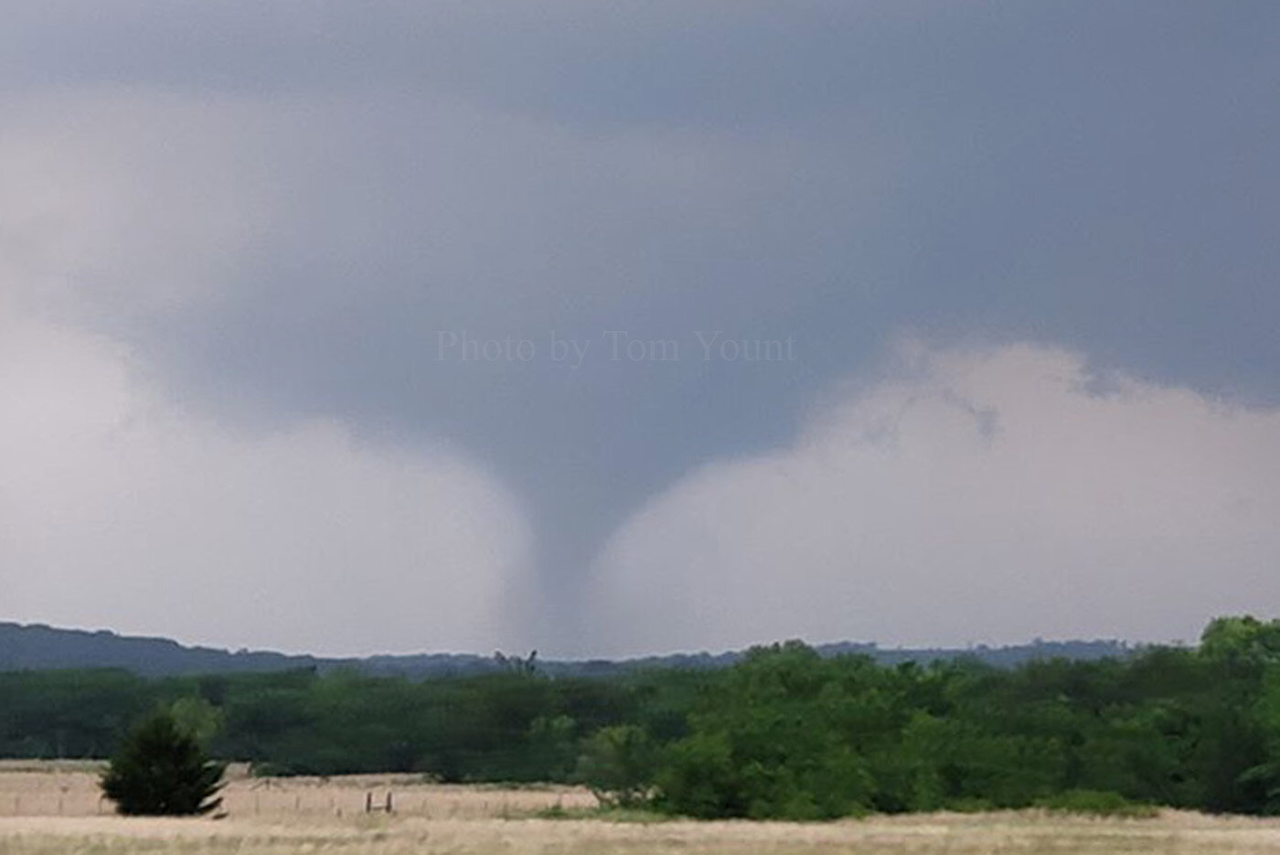
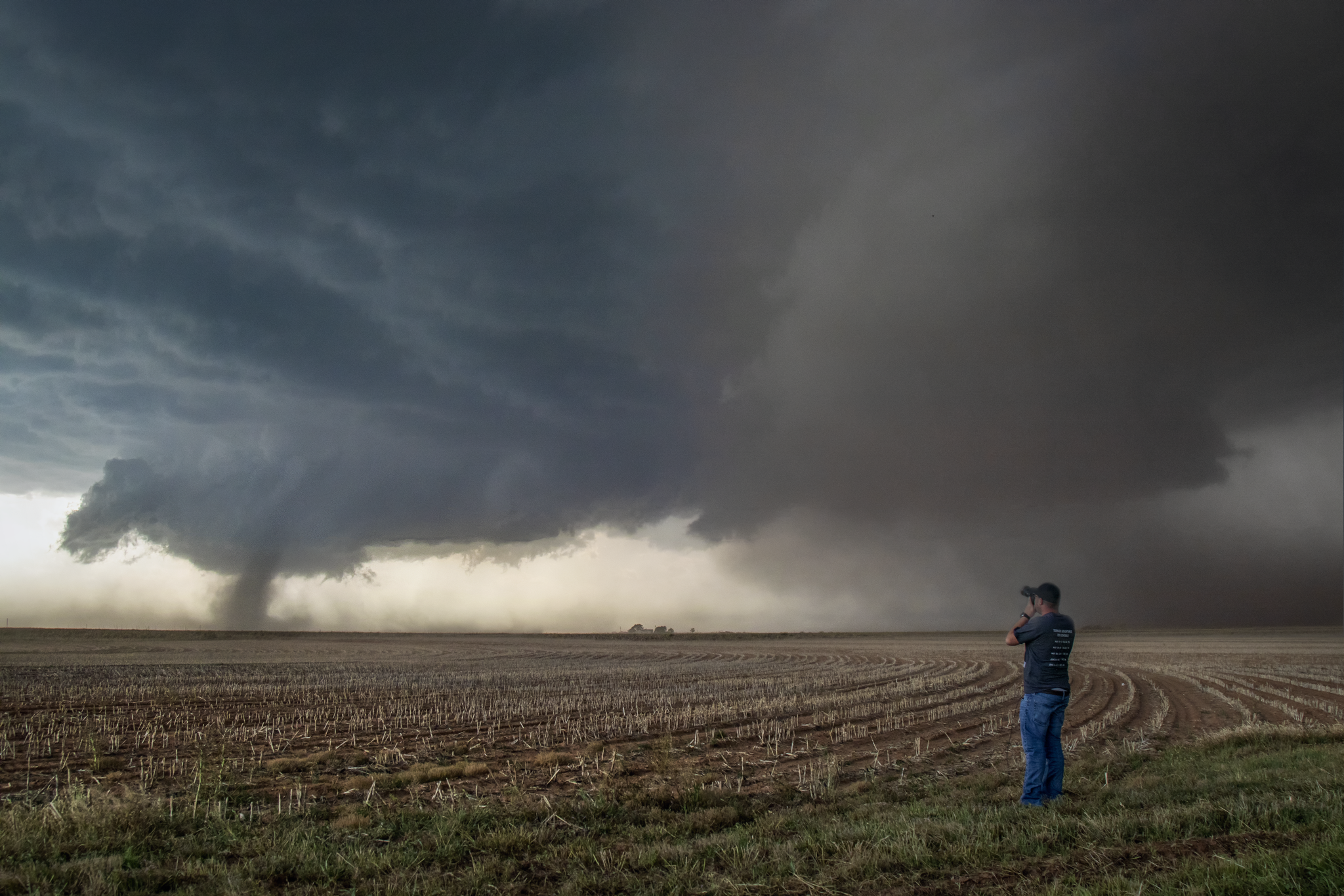
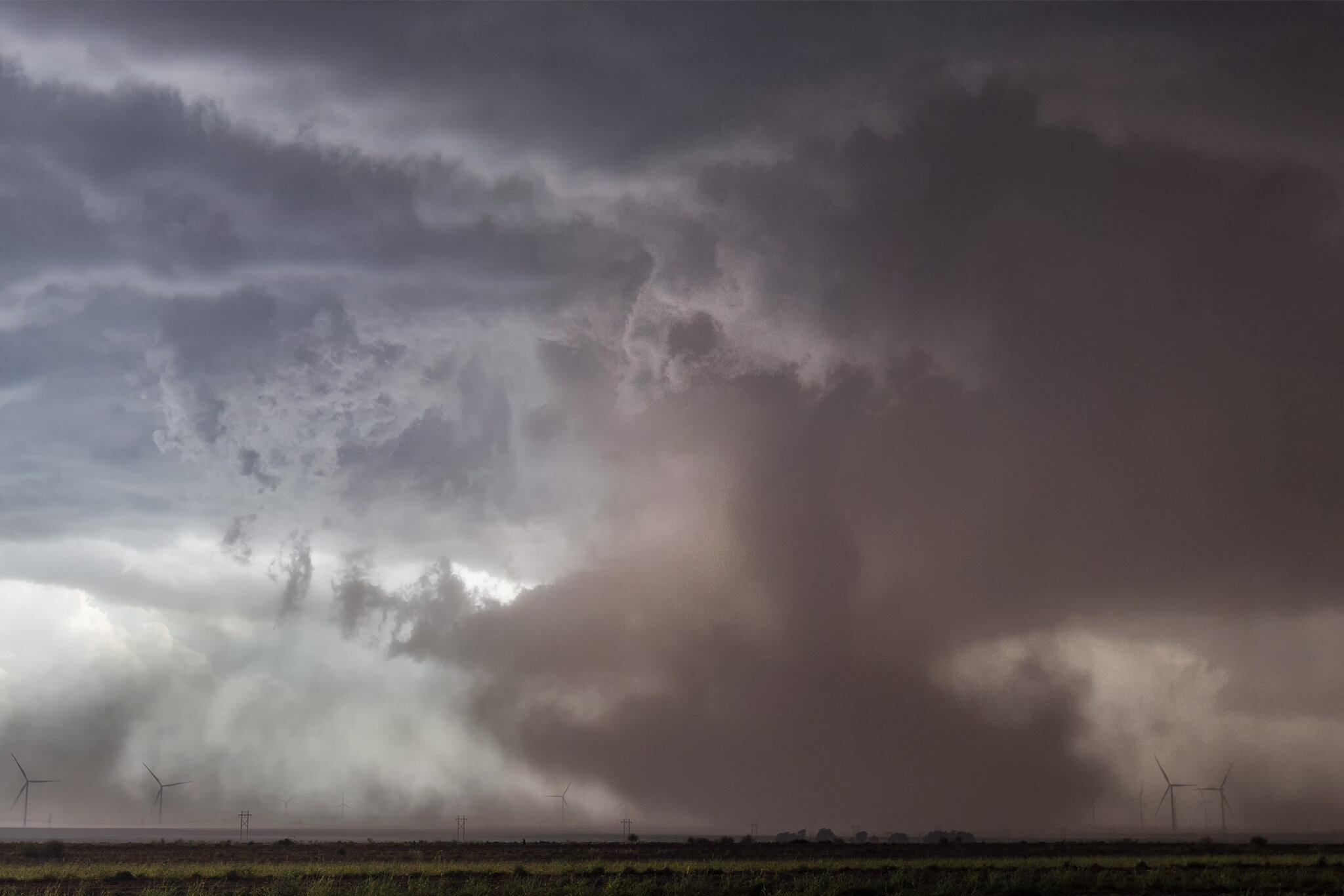
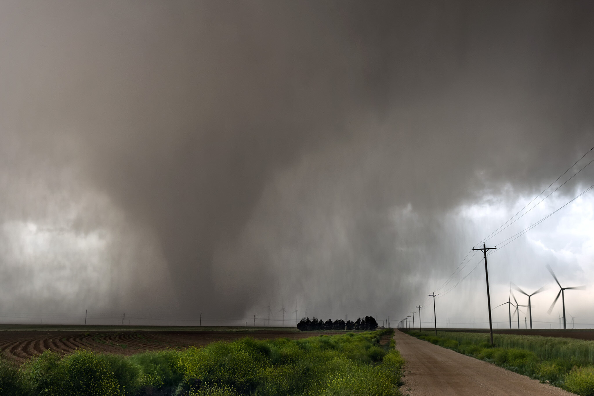
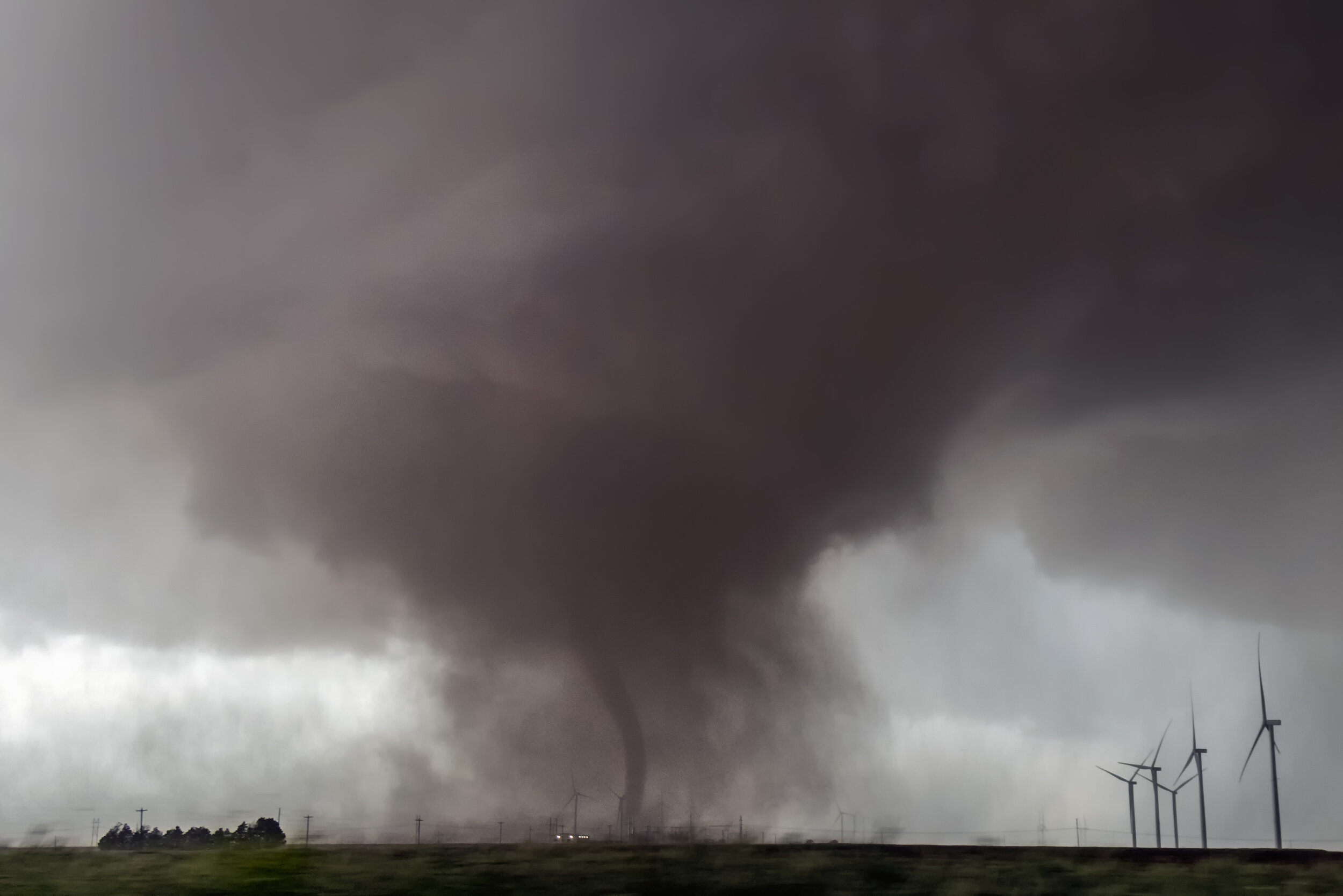
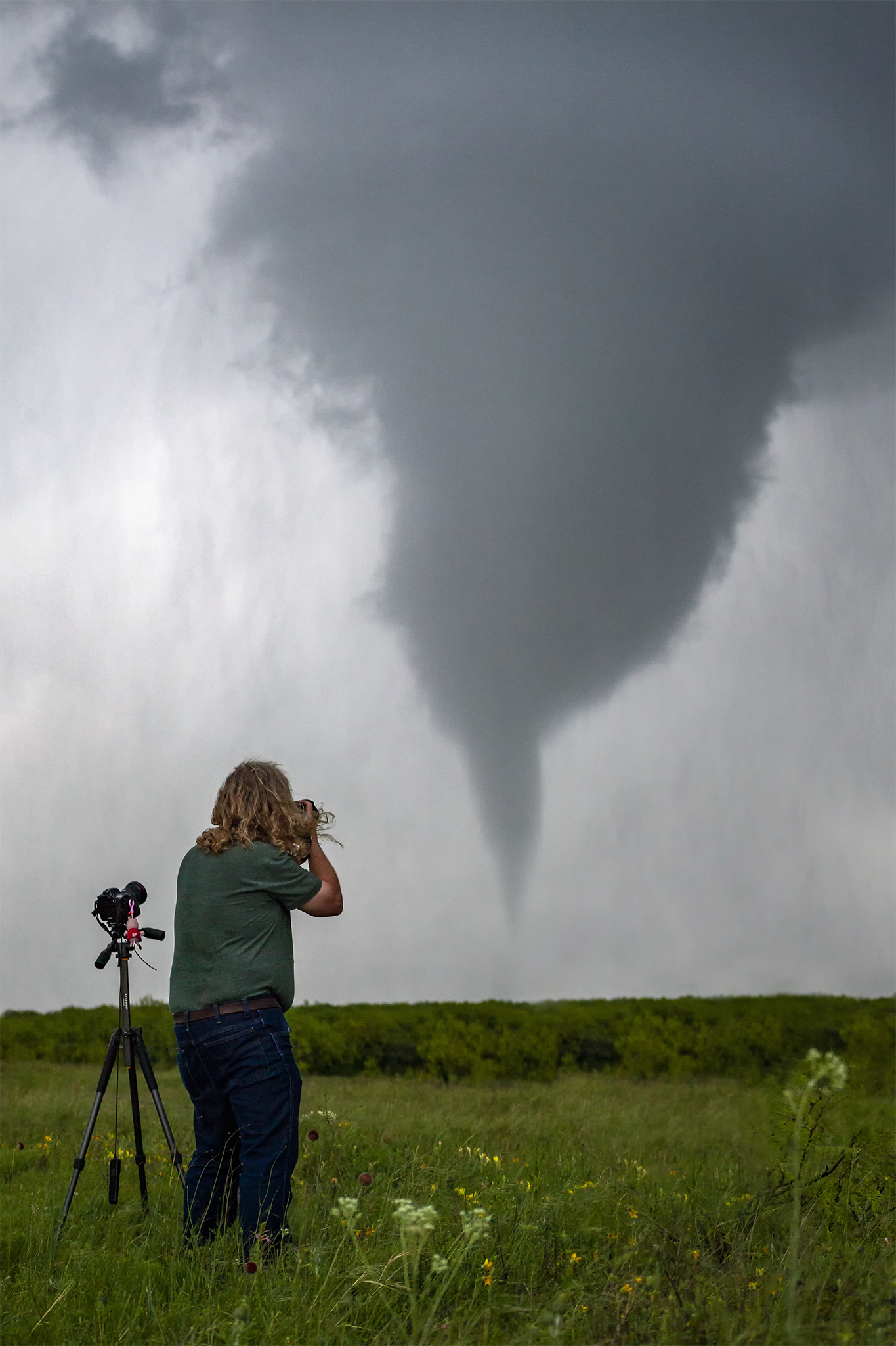
May 5, 2019 - tahoka, texas
close tornado intercept
These kind of days are why we chase. The morning started out with a 2% tornado probability and a slight risk in West Texas. We liked the Lubbock area, so we headed to town and got some lunch while waiting for storms to fire.
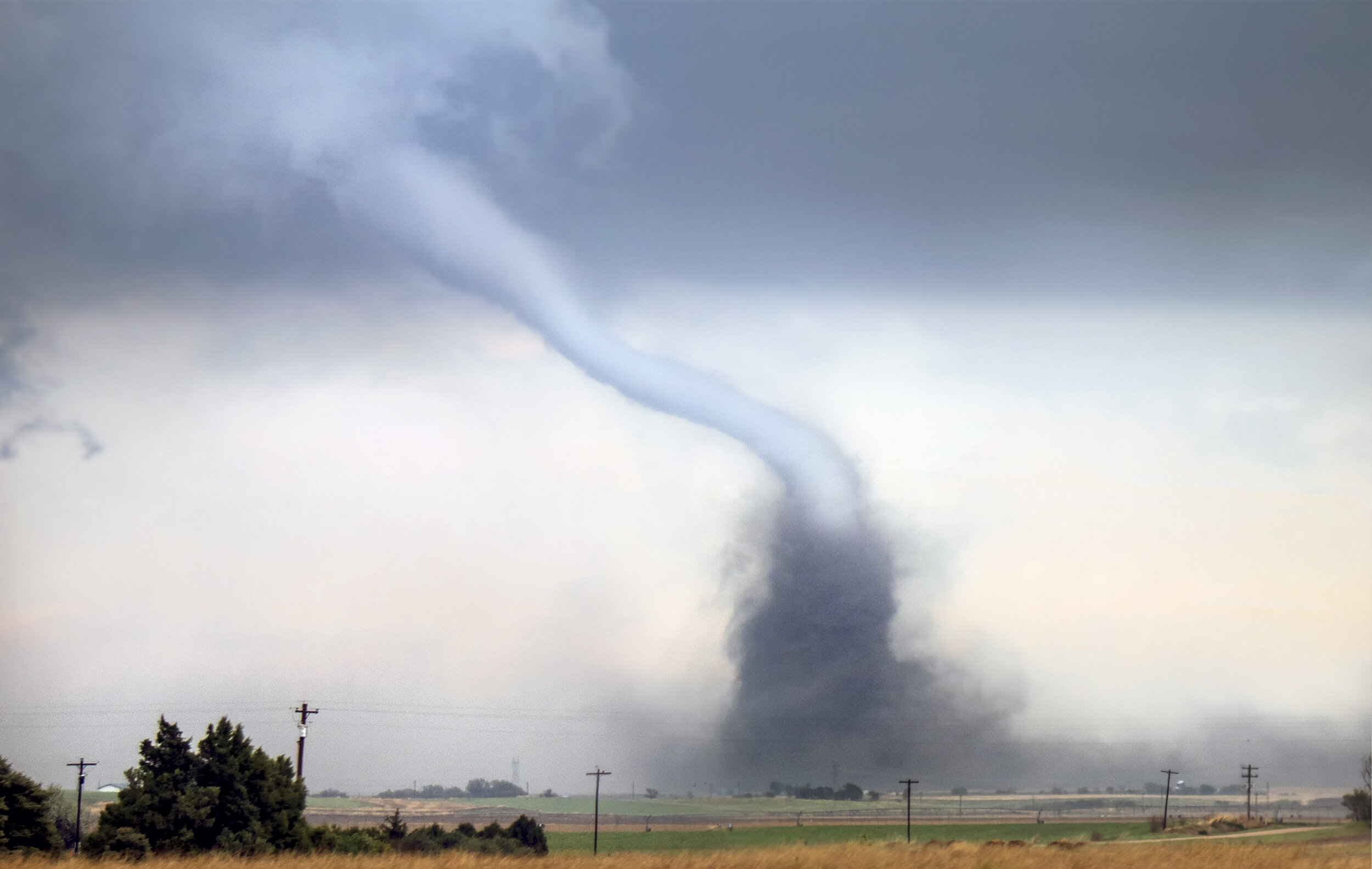
A storm formed southwest and north of town. We headed to the southwest storm. The storm started out elevated, so we drove through some small hail and got out ahead of the cell. We stopped at an open field near Tahoka, as the storm became surface based and starting sucking up large amount of dry dirt, both under the main wall cloud and inflow region. Slowly we could make out a tube inside the dust. We moved south on a collision course intercept with the tornado. Visibility varied throughout its lifecycle, with the dust occasionally subsiding to reveal various shapes of the tornado. We got within a quarter mile to the tornado before letting it cross Highway 18 as it became rainwrapped.
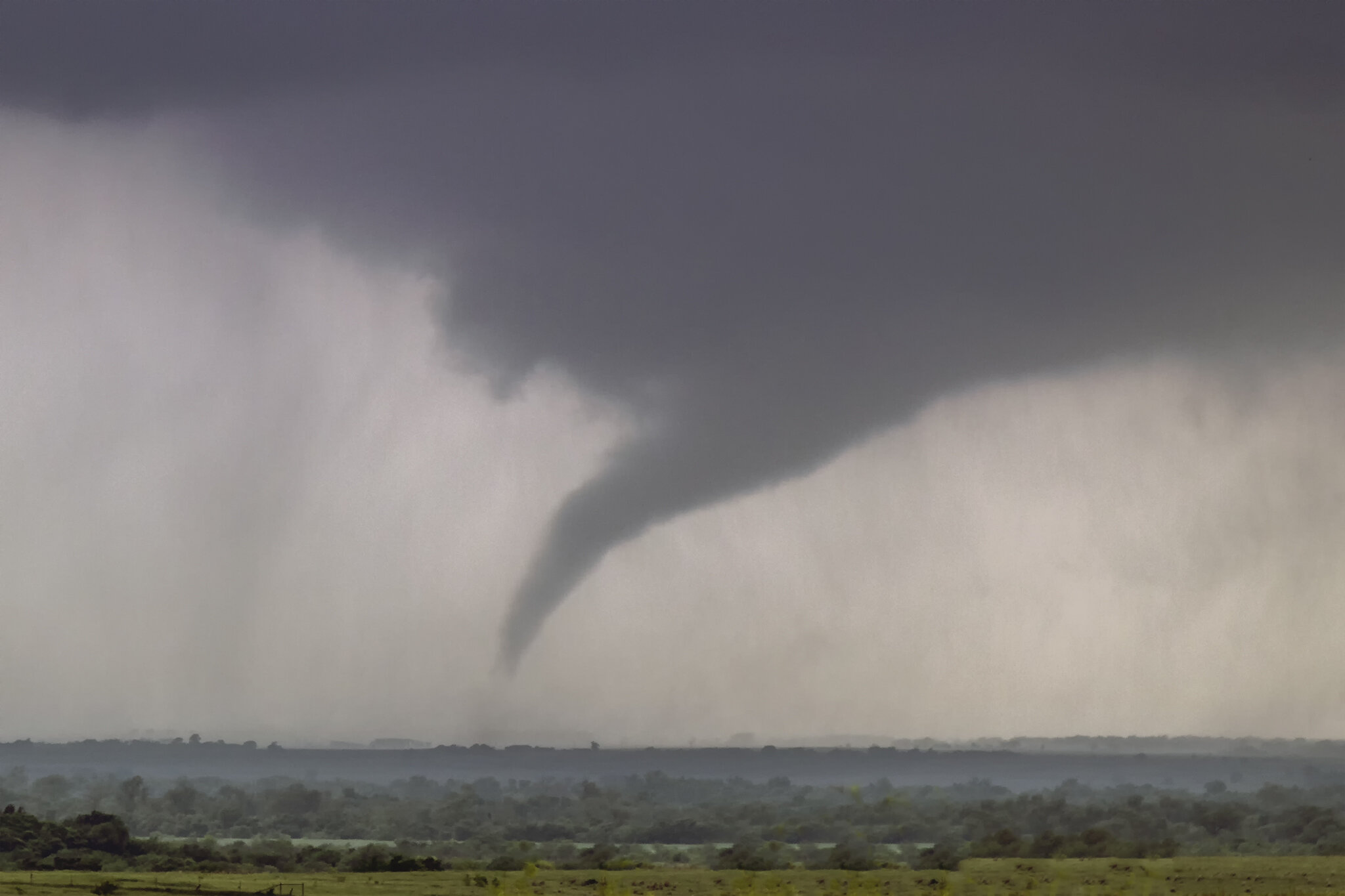
May 1, 2019 - seymour,
texas three tornadoes
This was pretty much as close to perfect as a chase day goes. SPC had North Texas in an Enhanced Risk with a broad 5% tornado risk. We targeted the town of Seymour, Texas. Just a short drive from the hotel we stayed at the night before.
We arrived in town well before initiation so we spent the downtime at the Whitestone Museum of Natural History (which is a hidden gem) and the town’s musical garden.
Storms finally fired southwest and east of town. We decided to drop to the southern storm as it was in a more pristine environment. A couple miles south of town we observed the storm was already producing a tornado, problem was there were absolutely no roads to get close, so we watched from a distance as the storm produced two tornadoes. The storm finally started moving closer to the highway so we intercepted the third tornado from closer range as it crossed Highway 183 and brilliantly occluded.
The tornadoes all stayed over rural areas and caused no significant damage, injuries, or fatalities.
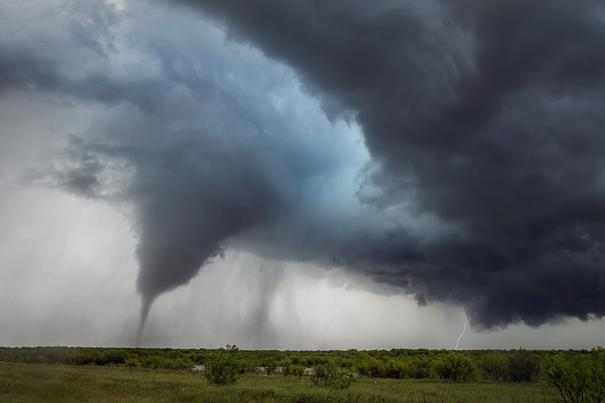
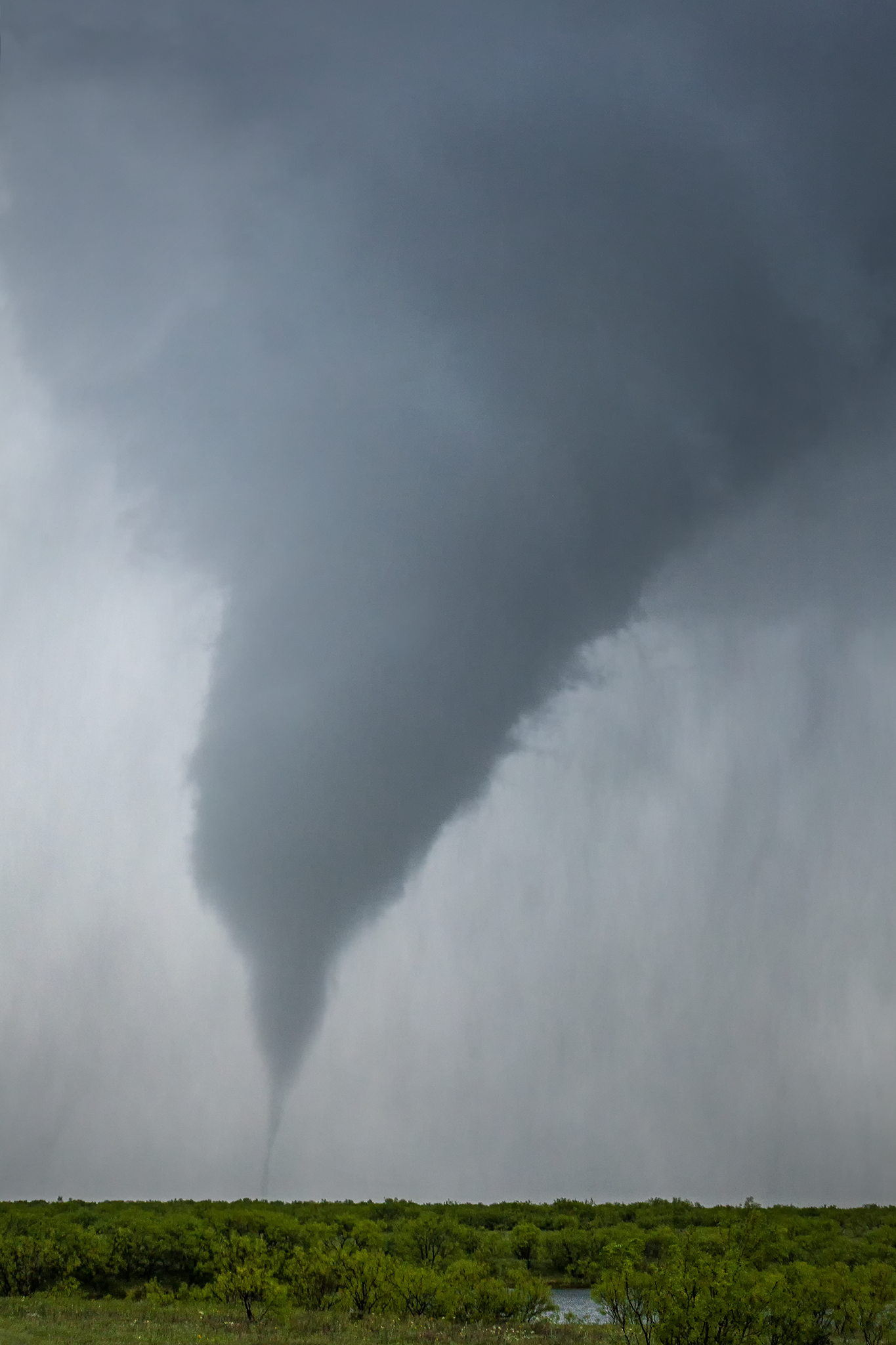
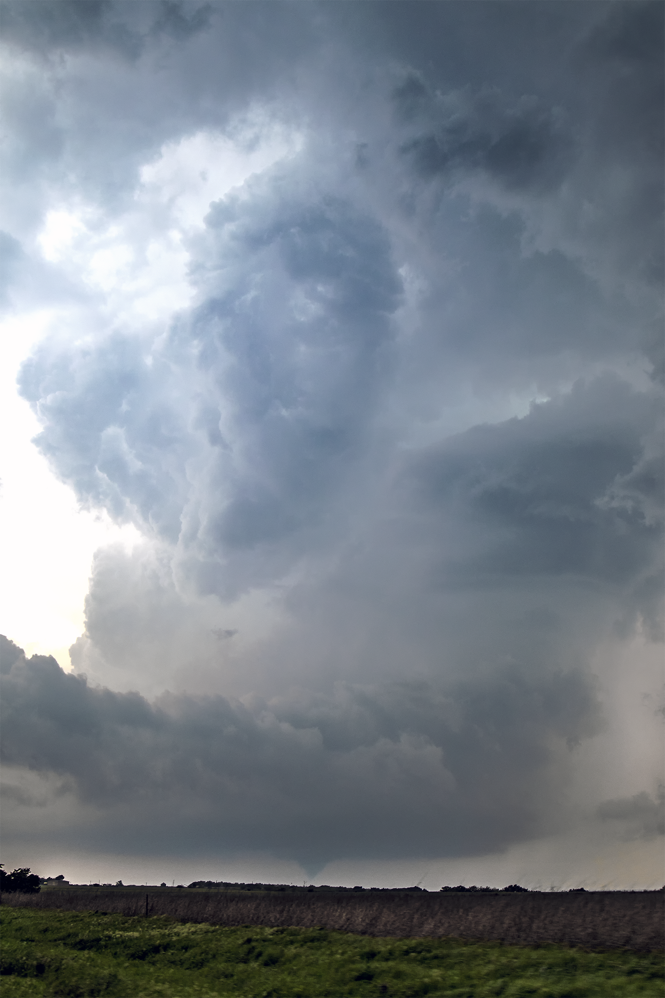
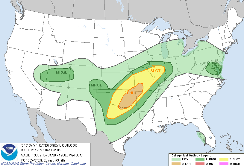
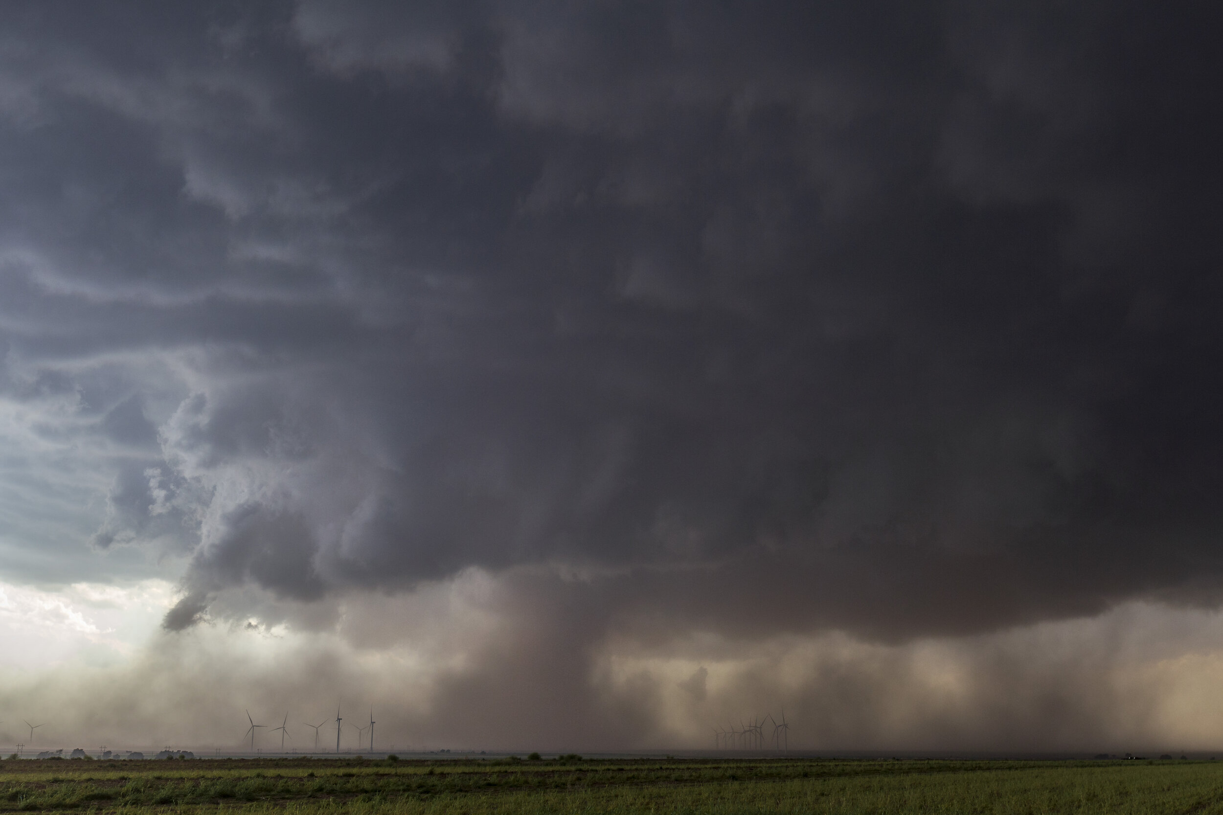
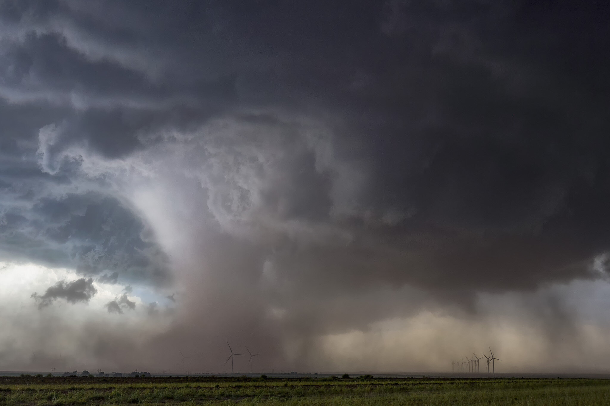
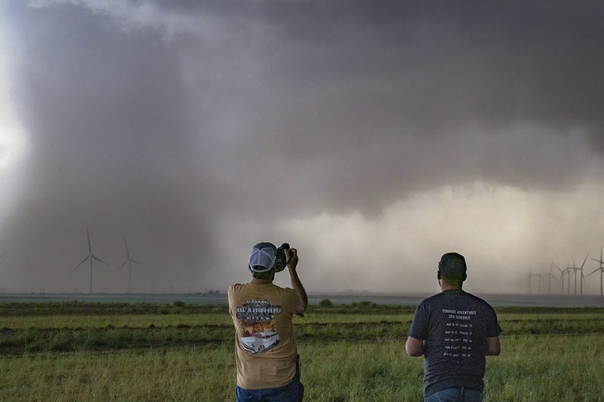
april 30, 2019 - Byers, texas
Two tornadoes
The day was given an Enhanced Risk for severe weather with a 10% area for tornadoes from the Red River to the north. We had to come from way down in Southwest Texas after chasing a marginal supercell with the group the day before.
Morning storms complicated the scenario, but we targeted storms coming off the dryline later in the day in Southern Oklahoma. Storms began firing and moving to the north but they seemed to be struggling in air that had been worked over by the early storms. Finally a storm in North Texas became established and we hustled back across the river as the first tornado warning was issued. We saw a cone tornado from a distance, but continued driving to move in closer hoping the storm had another cycle in it. It did and we watched from a hill, giving us a good vantage point of the tornado for several minutes. We ended the day after outflow rushed from the storm, giving us a great show beneath an undulating whale’s mouth.